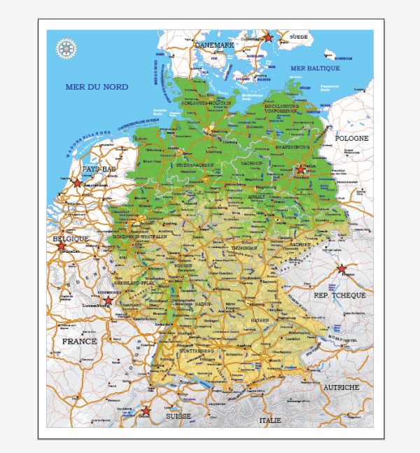
A general overview of Germany’s principal roads and railroads. Keep in mind that there may have been changes or developments since then.
Principal Roads:
- Autobahnen:
- Germany is famous for its Autobahnen, a network of high-speed highways known for sections without general speed limits.
- The Autobahn network spans across the country, connecting major cities and regions.
- Bundesstraßen:
- These are federal highways that complement the Autobahnen, linking towns and cities.
- Bundesstraßen are generally well-maintained and play a crucial role in the country’s road network.
- Landesstraßen:
- These are state roads that connect smaller towns and villages within a specific state or region.
Railroads:
- Deutsche Bahn (DB):
- Germany’s national railway company, Deutsche Bahn, operates an extensive network of trains that connect cities and regions across the country.
- High-speed trains like the Intercity-Express (ICE) connect major cities efficiently.
- Regional Railways:
- Germany has an efficient regional railway system connecting smaller towns and cities.
- Regional Express (RE) and Regionalbahn (RB) trains are common for short to medium distances.
- S-Bahn:
- The S-Bahn is a rapid transit system that operates in several major cities, including Berlin, Munich, Frankfurt, and others.
- It provides frequent and fast service within urban and suburban areas.
- Freight Railways:
- Germany has an extensive freight rail network, crucial for the transportation of goods within the country and to other European nations.
- High-Speed Rail:
- Germany has invested in high-speed rail connections, with the ICE trains reaching speeds of over 300 km/h (186 mph) on certain routes.
- Railway Stations:
- Major cities boast large and well-connected railway stations. Berlin Hauptbahnhof, for example, is one of the largest and most modern railway stations in Europe.
Please note that infrastructure and transportation networks are subject to change, and it’s advisable to check for the latest information from official sources if you require the most up-to-date details.


 Author: Kirill Shrayber, Ph.D. FRGS