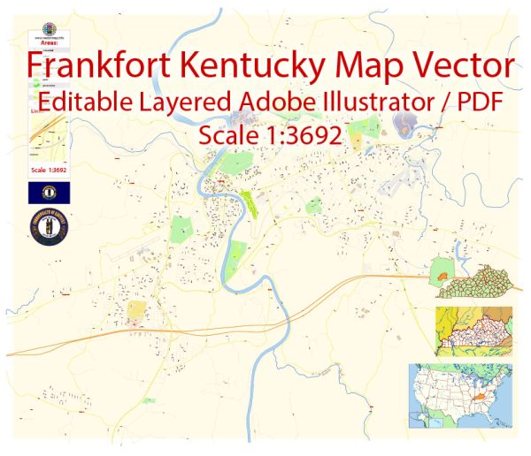
Frankfort, the capital city of Kentucky, has a network of streets and roads that form its transportation infrastructure. Here’s a general description of some principal streets and roads in Frankfort:
- Main Street: Main Street is a central thoroughfare in downtown Frankfort, hosting a variety of shops, restaurants, and businesses. It intersects with several other key roads and provides access to the State Capitol building.
- Capitol Avenue: Capitol Avenue is significant as it leads directly to the Kentucky State Capitol building. It is a prominent road in the downtown area.
- US Route 127: This highway runs through Frankfort, connecting the city to neighboring communities. It’s an important route for regional travel.
- US Route 60 (Versailles Road): Running east-west, US Route 60 passes through Frankfort and provides a connection to Versailles and Lexington to the west.
- US Route 421 (Leestown Road): Leestown Road is another major route in Frankfort, connecting the city to areas northwest of town.
- Highway 676 (East-West Connector): This road serves as an east-west connector, providing additional access and connectivity within the city.
- Holmes Street: Holmes Street is another street in downtown Frankfort, offering access to various businesses and government offices.
- Wilkinson Boulevard: This road runs along the Kentucky River and provides access to areas on the west side of Frankfort.
- Highway 1659 (Lawrenceburg Road): Lawrenceburg Road runs southward from Frankfort and provides a connection to Lawrenceburg and other southern areas.
- Highway 420 (New Circle Road): While not directly in Frankfort, New Circle Road is a major beltway around Lexington, and it indirectly connects to Frankfort via US Route 421.
These are just a few examples, and there are many more streets and roads that make up the transportation network in and around Frankfort. Keep in mind that road names and configurations can change, so it’s advisable to check for the latest maps or navigation information for precise details.


 Author: Kirill Shrayber, Ph.D.