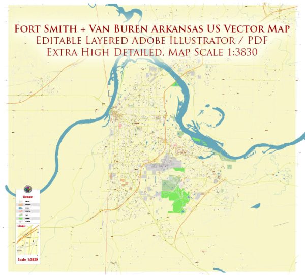
Fort Smith and Van Buren are neighboring cities in western Arkansas, United States. The transportation system in this region primarily relies on various modes of transportation, including highways, public transit, and air travel.
- Highways:
- Interstate 40 (I-40) is a major east-west highway that passes through the Fort Smith and Van Buren area, providing a crucial transportation route.
- Interstate 540 (I-540) connects Fort Smith to Fayetteville and provides a north-south route within the region.
- Local Roads:
- Fort Smith and Van Buren are connected by local roads, facilitating transportation between the two cities and within each city.
- Public Transit:
- Fort Smith has a public transit system, including bus services, operated by the Fort Smith Transit Department. These services help residents commute within the city.
- Van Buren may also have local transit options, although the extent and nature of these services might vary.
- Air Travel:
- Fort Smith Regional Airport serves as a key air transportation hub in the region, providing commercial flights, cargo services, and general aviation facilities.
- While Van Buren may not have its own airport, residents often use the Fort Smith Regional Airport for air travel.
- Rail Transportation:
- Historically, the area has had a significant connection to railroads, contributing to its economic development. While the prominence of rail transport has diminished over the years, there might still be rail infrastructure for freight transportation.
- Bicycle and Pedestrian Infrastructure:
- Efforts may have been made to enhance bicycle and pedestrian infrastructure within the cities, promoting alternative and sustainable modes of transportation.
Please verify this information with more recent sources, as developments in transportation infrastructure are subject to change. Local government websites, transportation departments, and community resources can provide the most up-to-date information on the principal transportation systems in Fort Smith and Van Buren, Arkansas.


 Author: Kirill Shrayber, Ph.D. FRGS