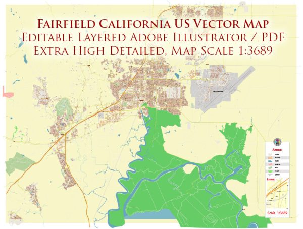
A general description of transportation systems in Fairfield, California, United States.
Fairfield is a city located in Solano County, California. The principal transportation systems in Fairfield include:
- Highways and Roads:
- Interstate 80 (I-80) runs through the southern part of Fairfield, connecting the city to other major cities in the region, such as Sacramento and San Francisco.
- State Route 12 (SR 12) is another significant highway in the area, providing connections to Napa and other parts of Northern California.
- Public Transit:
- Solano County Transit (SolTrans) operates public transit services in the city, including buses that connect Fairfield to neighboring cities like Vallejo.
- The Bay Area Rapid Transit (BART) system, while not directly in Fairfield, has stations in nearby cities like Vallejo, offering commuter rail services to San Francisco and other parts of the Bay Area.
- Airports:
- The closest major airport to Fairfield is the Sacramento International Airport (SMF), located approximately 50 miles to the northeast. This airport provides domestic and limited international flights.
- Rail:
- Fairfield does not have its own passenger rail service, but Amtrak provides rail services in nearby cities like Martinez and Davis, offering connections to other parts of California and the United States.
- Bicycle and Pedestrian Infrastructure:
- The city may have implemented bike lanes, sidewalks, and pedestrian-friendly features to promote alternative modes of transportation and enhance the overall transportation network.
- Goods Movement:
- Given its location along Interstate 80, Fairfield plays a role in the movement of goods and freight. There are likely distribution centers, logistics facilities, and trucking routes supporting the local economy.
It’s important to verify this information with local transportation authorities or updated sources, as infrastructure and services may have evolved since my last update.


 Author: Kirill Shrayber, Ph.D. FRGS