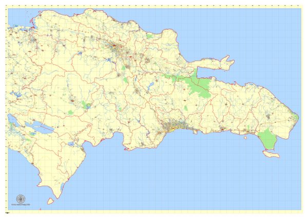
The transportation system in the Dominican Republic is a combination of various modes of transportation, including roadways, air travel, maritime transport, and public transit. Here’s an overview of the principal transportation systems in the Dominican Republic:
- Road Transportation:
- Road Network: The Dominican Republic has an extensive road network that connects major cities and towns. The road infrastructure includes highways, expressways, and local roads.
- Public Transportation: Public buses and minibusses are common modes of public transportation in urban and rural areas. Several private companies operate bus services between cities.
- Air Transportation:
- Airports: The Dominican Republic has several international airports, with Punta Cana International Airport, Las Américas International Airport in Santo Domingo, and Cibao International Airport in Santiago being among the busiest.
- Domestic Flights: Domestic flights connect major cities and tourist destinations, providing a quicker means of transportation within the country.
- Maritime Transportation:
- Ports: The country has several ports, with the Port of Santo Domingo being a significant hub for maritime trade. Other ports include Puerto Plata and Caucedo.
- Ferries: Ferries operate between certain coastal cities and nearby islands.
- Public Transit:
- Urban Transit: Public buses and minibusses serve urban areas, and larger cities may have their own public transit systems.
- Metro: Santo Domingo has a metro system, providing a rapid transit option for residents and visitors.
- Taxis and Ride-Sharing:
- Taxis are available in urban areas and are a common mode of transportation for both locals and tourists.
- Ride-sharing services, such as Uber, are also available in certain cities.
- Car Rentals:
- Car rental services are widely available, offering tourists and locals the flexibility to explore the country at their own pace.
- Motorcycles and Scooters:
- Motorcycles are a popular means of transportation, especially in urban areas. Motorcycle taxis, known as “motoconchos,” are a common sight.
- Rail Transportation:
- Historically, the Dominican Republic had a railway network, but it has been limited in recent years. Efforts have been made to revitalize and expand the railway system for both freight and passenger transportation.
It’s important to note that the transportation infrastructure may vary in different regions of the country, and improvements or changes may have occurred since my last update. Always check for the latest information before planning any travel.


 Author: Kirill Shrayber, Ph.D. FRGS