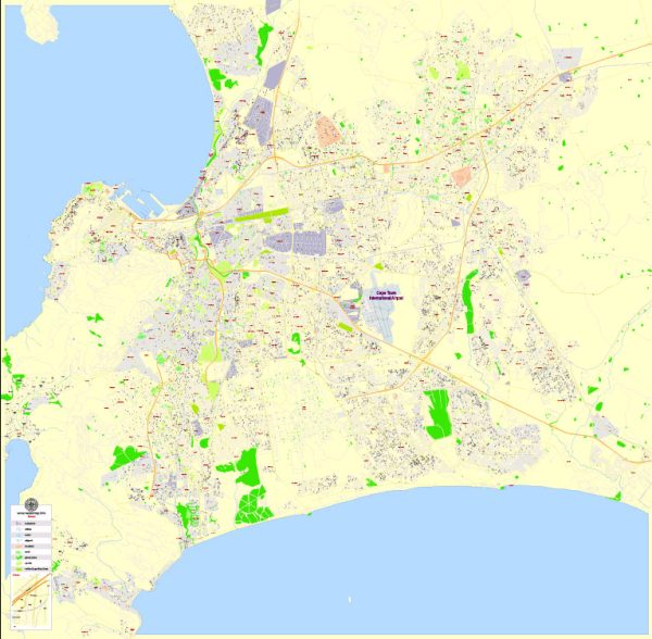
Cape Town, located in South Africa, is a city known for its stunning landscapes, diverse cultures, and rich history. The city is characterized by a network of roads and streets that connect its various neighborhoods and landmarks. Here are some of the principal streets and roads in Cape Town:
- Adderley Street:
- One of the main streets in Cape Town’s central business district.
- Lined with shops, restaurants, and historical buildings.
- Long Street:
- Known for its vibrant nightlife, eclectic shops, and cultural diversity.
- Features Victorian architecture and is a popular destination for tourists.
- Kloof Street:
- Runs through the neighborhoods of Gardens and Tamboerskloof.
- Home to a variety of trendy shops, cafes, and restaurants.
- Buitengracht Street:
- Connects the city center to the neighborhoods of Gardens and Oranjezicht.
- Offers scenic views of Table Mountain.
- De Waal Drive:
- A scenic route that runs along the slopes of Table Mountain.
- Provides panoramic views of the city, Table Bay, and the surrounding areas.
- Nelson Mandela Boulevard:
- A major arterial road that connects the city center with the N2 highway.
- Named in honor of Nelson Mandela, the iconic leader of South Africa.
- Main Road (M4):
- Runs along the coastline, connecting Cape Town to the southern suburbs.
- Passes through areas like Sea Point, Green Point, and Camps Bay.
- M3 Freeway:
- Connects the southern suburbs to the city center and northern suburbs.
- Provides access to the University of Cape Town and the Kirstenbosch National Botanical Garden.
- M5 Freeway:
- Connects the southern and northern suburbs, passing through areas like Rondebosch and Pinelands.
- Airport Approach Road:
- Connects Cape Town International Airport to the city center.
- Vital for travelers arriving or departing from the airport.
- Strand Street:
- Located in the central business district, running parallel to the waterfront.
- Offers access to the Victoria & Alfred Waterfront.
Remember that traffic conditions can vary, so it’s advisable to check real-time information if you are planning to navigate the city. Additionally, road names and infrastructure may evolve, so it’s good to have the latest local maps or navigation tools at your disposal.


 Author: Kirill Shrayber, Ph.D. FRGS