Editable Map World Robinson

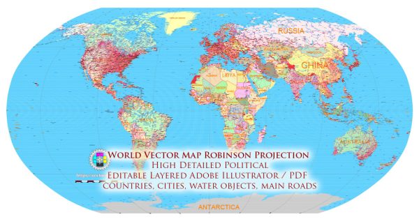
Editable Map — World Robinson

A clean editable map of World Robinson with named layers and consistent geometry for fast cartographic work. Crisp vectors preserve edges at high DPI and export compactly for web delivery. District and neighborhood labels are arranged to avoid collisions around dense cores. The file accepts custom grids, legends and callouts without redrawing base content. Layer structure separates arterials and locals, districts, hydrography, parks and landmarks. Contours and landuse layers can be toggled to match tourism or planning use cases.

Saves prepress time by reducing manual fixes and keeping the visual system consistent. Ideal for signage, event maps, campus leaflets and waterfront brochures. Files remain compact thanks to clean geometry and disciplined labeling. Editors can brand the palette and icons, then export sharp results for both print and web. The map integrates neatly with common DTP and GIS workflows.

The highest mountain peaks on the planet are part of the Himalayan and Karakoram mountain ranges in Asia. Here are the five highest mountain peaks:

  1. Mount Everest: Located in the Himalayas on the border between Nepal and the Tibet Autonomous Region of China, Mount Everest is the highest peak in the world, with an elevation of 8,848 meters (29,029 feet).
  2. K2 (Mount Godwin-Austen): Also known as Mount Godwin-Austen, K2 is the second-highest peak globally, situated on the China-Pakistan border in the Karakoram Range. Its elevation is 8,611 meters (28,251 feet).
  3. Kangchenjunga: This mountain is the third-highest in the world and lies on the India-Nepal border. Kangchenjunga has an elevation of 8,586 meters (28,169 feet).
  4. Lhotse: Part of the Everest massif, Lhotse is the fourth-highest mountain globally, with an elevation of 8,516 meters (27,940 feet).
  5. Makalu: Also located in the Himalayas, Makalu is the fifth-highest mountain, with an elevation of 8,485 meters (27,838 feet).

Keep in mind that these elevations are subject to change due to geological and climatic factors. For the latest information, it’s advisable to check the most recent sources or updates from relevant authorities.

Author: Kirill Shrayber, Ph.D.

I have been working with vector cartography for over 25 years, including GPS, GIS, Adobe Illustrator and other professional cartographic software.
Linkedin: https://www.linkedin.com/in/kirill-shrayber-0b839325/
Twitter: https://twitter.com/vectormapper

Are we missing some maps? Let us know!!!
What map do you need?

    We will upload it within the next 24 hours and notify you by Email.

    Menu