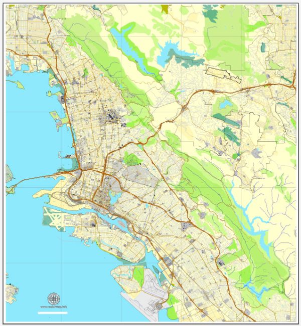
Alameda, Oakland, and Berkeley are three neighboring cities located in the East Bay region of the San Francisco Bay Area in California, USA. Each city has its own unique character and amenities, contributing to the diversity of the area. Here’s a brief description of the urban amenities in each city:
- Alameda:
- Alameda is an island city with a laid-back atmosphere and a mix of residential and commercial areas.
- The city is known for its historic Victorian architecture, tree-lined streets, and charming neighborhoods.
- Crown Memorial State Beach and Robert W. Crown Memorial State Beach offer residents and visitors a place for outdoor activities and relaxation.
- Alameda has a vibrant downtown area with a variety of shops, restaurants, and cafes.
- The city is also home to parks, golf courses, and cultural attractions.
- Oakland:
- Oakland is a diverse and dynamic city with a thriving arts and culture scene.
- The city’s waterfront area, including Jack London Square, offers a mix of dining, entertainment, and shopping options.
- Oakland is known for its numerous parks and outdoor spaces, including Lake Merritt, which is a large urban estuary and a designated National Wildlife Refuge.
- The city has a rich history in the civil rights movement and is home to a variety of museums and cultural institutions, such as the Oakland Museum of California.
- Oakland has a bustling food scene, reflecting its diverse population, and hosts various events and festivals throughout the year.
- Berkeley:
- Berkeley is known for its progressive and academic character, being the home of the University of California, Berkeley.
- The city has a vibrant arts and music scene, with numerous theaters, galleries, and live music venues.
- Berkeley is famous for its culinary offerings, including a wide range of international cuisines and a focus on locally sourced, organic ingredients.
- The Berkeley Hills provide stunning views of the Bay Area, and Tilden Regional Park offers recreational opportunities such as hiking, picnicking, and a botanical garden.
- Telegraph Avenue is a lively commercial district near the university, known for its eclectic shops and street performers.
All three cities benefit from their proximity to San Francisco and other Bay Area attractions, providing residents with access to a wide range of cultural, recreational, and employment opportunities. The combination of urban amenities and natural beauty makes this area a popular and desirable place to live.


 Author: Kirill Shrayber, Ph.D. FRGS