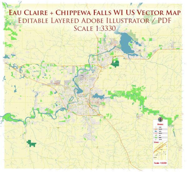
General information about water resources and bridges in Eau Claire and Chippewa Falls, Wisconsin.
- Chippewa River:
- The Chippewa River is a significant water resource in the area. It flows through both Eau Claire and Chippewa Falls, playing a crucial role in the local ecosystem.
- Bridges:
- Eau Claire and Chippewa Falls are likely to have various bridges spanning the Chippewa River and other water bodies. These bridges are essential for transportation and connectivity in the region.
- Local Infrastructure:
- The region generally invests in maintaining and upgrading its infrastructure, including bridges and water-related facilities.
- Local Authorities:
- Information about specific water resources and bridges can be obtained from local authorities, such as the city government, county officials, or relevant agencies responsible for infrastructure management.
- Community Involvement:
- Local communities often play an active role in preserving and enhancing water resources. There might be community organizations or initiatives focused on environmental conservation and the maintenance of bridges.
To get the most accurate and current information about water resources and bridges in Eau Claire and Chippewa Falls, I recommend checking with the following sources:
- City or County Government Offices: Contact the local government offices in Eau Claire and Chippewa Falls for information on water resources, infrastructure projects, and bridge maintenance.
- Department of Natural Resources (DNR): State agencies, such as the Wisconsin Department of Natural Resources, may have information on water resources, environmental conservation, and related projects.
- Public Works Departments: Local public works departments often handle infrastructure projects, including bridges. They can provide details on bridge conditions, maintenance, and any planned developments.
- Community Organizations: Environmental and community organizations in the area may have information on local water conservation efforts and infrastructure projects.


 Author: Kirill Shrayber, Ph.D. FRGS