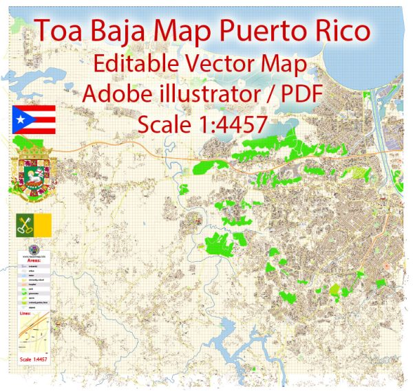
Here are some key details about Toa Baja, Puerto Rico:
- Toa Baja is a municipality located in the northern coastal region of Puerto Rico, about 20 miles west of San Juan.
- Originally founded in 1745 as a town called Sabana Seca, it was officially named Toa Baja in 1760. The name means “lower Toa,” distinguishing it from nearby Toa Alta (“upper Toa”).
- Economic activities in Toa Baja historically centered around agriculture and livestock production. Sugarcane, fruits, vegetables, and dairy cows were important local industries.
- As Puerto Rico industrialized in the 20th century, Toa Baja transitioned into more of a suburban residential area within the San Juan metropolitan region. It experienced significant population growth and expansion of urban development.
- Today, Toa Baja has about 89,000 residents and is considered highly urbanized. However, some small farms and agricultural operations still persist amidst subdivisions and commercial areas.
- Much of Toa Baja’s current economy relies on construction, manufacturing, services, and retail trade supporting the local population. It contains shopping centers, hospitals, and mid-size factories and warehouses.
So in summary, Toa Baja moved from its agricultural beginnings over 200 years ago to become an integrated suburb within metro San Juan’s urban footprint today.
Here is a general overview of the history of urban development in Puerto Rico:
Early Development
- Prior to Spanish colonization in the late 15th century, the indigenous Taíno people lived in small villages and subsisted on agriculture.
- After Puerto Rico became a Spanish colony, settlements began to grow into more urbanized towns and cities centered around ports, fortresses and town squares. San Juan, founded in 1521, became the center of Spanish colonial administration.
Spanish Colonial Era
- Under Spanish rule which lasted until 1898, many new cities emerged across the island. Towns were built on a grid plan with a central plaza, church and town hall. Economic activity focused on ports and agricultural plantations using slave labor.
American Influence
- After the Spanish-American War in 1898, Puerto Rico came under U.S. control. American companies and infrastructure drove economic growth.
- Rapid industrialization and demographic shifts in the mid-20th century led to expansion of urban areas. Many people migrated from rural areas into growing cities like San Juan and Ponce.
Modern Times
- By the later 20th century, Puerto Rico became heavily urbanized, with cities and surrounding metropolitan areas home to most of the island’s population. Problems with urban poverty, informal housing and overcrowding emerged.
- After economic recession in recent decades, urban development slowed across much of Puerto Rico. Efforts have focused on revitalizing historic city centers and upgrading infrastructure.


 Author: Kirill Shrayber, Ph.D. FRGS