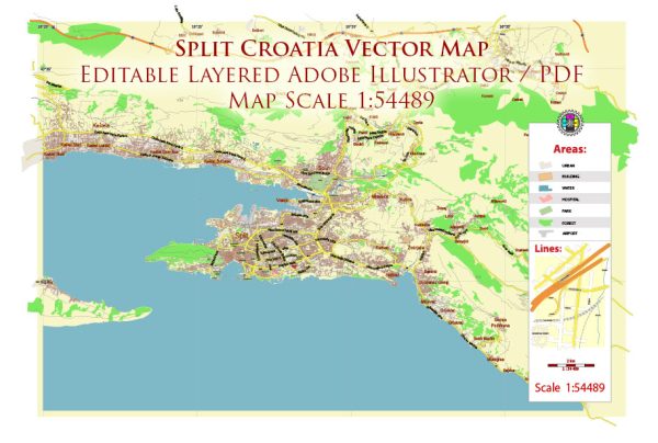
Split, located on the Adriatic coast of Croatia, is one of the oldest continuously inhabited cities in the region. Its history dates back to the time of the Roman Empire, and its urban development reflects the influence of various civilizations and architectural styles. Here is a brief overview of Split’s history of urban development:
- Roman Era (3rd-4th centuries AD):
- Split’s foundation is traditionally associated with the construction of Diocletian’s Palace, commissioned by the Roman Emperor Diocletian in the early 4th century AD.
- The palace was a massive fortified complex with residential, religious, and administrative buildings. It played a dual role as a luxurious residence for Diocletian and a military fortress.
- Medieval Period (5th-15th centuries):
- Following the fall of the Roman Empire, Split experienced the influence of various medieval powers, including the Byzantines, Venetians, and Croatian kings.
- The city gradually expanded beyond the walls of Diocletian’s Palace, with the construction of churches, houses, and other structures.
- Venetian Rule (15th-18th centuries):
- Split came under Venetian rule in the 15th century, and during this period, many Gothic and Renaissance-style buildings were constructed.
- The city’s fortifications were strengthened, and several palaces and churches, such as the Cathedral of St. Domnius, were built or renovated.
- Habsburg Monarchy and Austro-Hungarian Empire (18th-19th centuries):
- In the 18th century, Split became part of the Habsburg Monarchy, and later the Austro-Hungarian Empire. This period saw the continuation of architectural development influenced by Baroque and neoclassical styles.
- The city’s infrastructure was improved, and public spaces were redesigned.
- Yugoslav Period (20th century):
- After World War I, Split became part of the Kingdom of Yugoslavia. During World War II, the city suffered damage, but post-war reconstruction efforts helped restore and modernize its urban fabric.
- In the socialist era of Yugoslavia, urban development projects aimed at providing housing and infrastructure continued.
- Contemporary Period (1991-present):
- The breakup of Yugoslavia in the early 1990s and the Croatian War of Independence had some impact on Split, but the city recovered relatively quickly.
- In recent years, Split has experienced tourism-driven economic growth, leading to the development of modern amenities and infrastructure while preserving its historic core.
Throughout its history, Split’s urban development has been shaped by its strategic location, various ruling powers, and the evolution of architectural styles. Today, the historic center, including Diocletian’s Palace, is a UNESCO World Heritage site and a vibrant part of the city.


 Author: Kirill Shrayber, Ph.D. FRGS