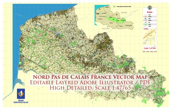
The Nord-Pas-de-Calais region in France has a rich history of urban development that has been shaped by various factors, including its strategic location, industrialization, and historical events. The region is located in the northern part of France, bordering Belgium, and has historically been a significant center for trade and commerce.
- Medieval Period: The region has a history dating back to medieval times when it was part of the County of Flanders. Cities like Lille, Arras, and Douai were established during this period and served as important trading centers. The architecture from this era is evident in some of the historic buildings and structures that still stand today.
- Spanish and Austrian Rule: The region experienced a period of Spanish and later Austrian rule in the 17th and 18th centuries. This had an impact on the urban development, introducing some architectural styles and influences from these periods.
- Industrial Revolution: The 19th century brought about significant changes with the onset of the Industrial Revolution. The region became a major industrial hub, with coal mining and textile industries playing a crucial role. Cities like Lille and Roubaix experienced rapid urbanization and population growth as people flocked to the region for work in the expanding industries.
- World Wars: The Nord-Pas-de-Calais region was heavily impacted by both World War I and World War II. The area witnessed extensive damage during the wars, leading to reconstruction efforts in the post-war period. Cities and towns were rebuilt, and modern urban planning principles started to influence the development of the region.
- Post-World War II Era: The post-war period saw the continuation of industrial development, but also a shift towards a more diversified economy. The coal mining industry, which had been a major economic driver, declined, leading to the need for economic restructuring. Urban planning aimed at revitalizing city centers and adapting to changing economic landscapes became a priority.
- Euroregion Development: In recent years, the Nord-Pas-de-Calais region has been part of cross-border collaborations, especially with neighboring Belgium. The concept of the Euroregion, where cities from different countries collaborate on various levels, has influenced urban development strategies in the region.
- Cultural and Educational Development: Cities like Lille have also focused on cultural and educational development. Lille, for example, has become known for its cultural events, universities, and modern infrastructure.
Throughout its history, the Nord-Pas-de-Calais region has undergone significant transformations, adapting to economic shifts, recovering from wartime devastation, and embracing modern urban planning concepts. Today, the region reflects a blend of historical charm, industrial heritage, and contemporary urban development.


 Author: Kirill Shrayber, Ph.D. FRGS