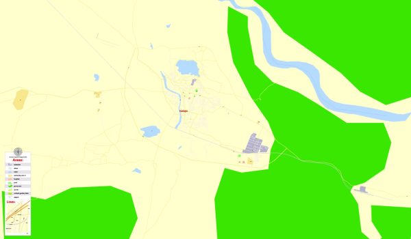
Kadapa (formerly known as Cuddapah) is a city located in the Rayalaseema region of Andhra Pradesh, India. Please note that developments may have occurred since then.
The history of urban development in Kadapa can be traced back to ancient times. Here is a brief overview:
- Ancient History: Kadapa has a rich history, with evidence of human habitation dating back to the Paleolithic era. The region has witnessed the rule of various dynasties, including the Mauryas, Satavahanas, Pallavas, Cholas, and Chalukyas.
- Vijayanagara Empire: During the medieval period, Kadapa came under the influence of the Vijayanagara Empire. The city flourished culturally and economically during this time.
- Nawabs of Cuddapah: In the 16th century, the region was ruled by the Nawabs of Cuddapah. The city played a significant role in the political landscape during this period.
- British Era: With the decline of the Vijayanagara Empire, the British East India Company gained control over the region. Kadapa became an important administrative and trade center during the British colonial period.
- Post-Independence Development: After India gained independence in 1947, Kadapa continued to develop as a major urban center in Andhra Pradesh. The city witnessed infrastructural development, educational institutions, and industrial growth.
- Economic Activities: Kadapa is known for its economic activities in sectors such as agriculture, with the surrounding region being agriculturally rich. The city has also seen growth in industries like cement, textiles, and mining.
- Education and Healthcare: Over the years, Kadapa has developed as an educational hub with the establishment of schools, colleges, and universities. The city also provides healthcare facilities to the region.
- Transportation: The city’s transportation infrastructure has evolved, connecting it to other major cities in Andhra Pradesh and neighboring states. Roadways and railways have played a crucial role in facilitating connectivity.
- Cultural Heritage: Kadapa boasts a cultural heritage that reflects the amalgamation of various historical influences. Temples, mosques, and other historical structures stand as testaments to the city’s rich past.
It’s essential to refer to more recent sources for the latest information on Kadapa’s urban development, as developments and initiatives continue to shape the city’s landscape. Local government records, urban planning documents, and recent news articles can provide up-to-date information on Kadapa’s current urban development scenario.


 Author: Kirill Shrayber, Ph.D. FRGS