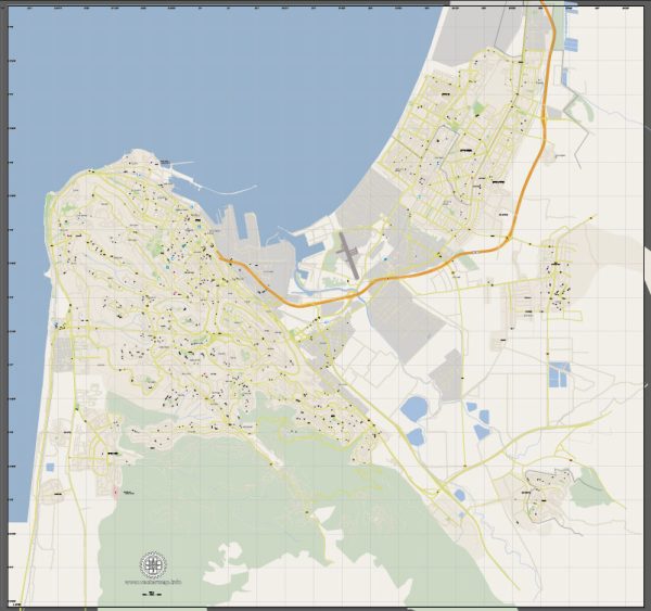
Haifa, located in northern Israel along the Mediterranean coast, has a rich history of urban development that spans thousands of years. The city’s strategic location has made it a significant center for trade, culture, and industry throughout its history.
- Ancient History:
- Haifa has ancient roots dating back to biblical times. It is mentioned in the Hebrew Bible (Old Testament) as one of the cities allotted to the tribe of Zebulun.
- Over the centuries, various civilizations, including the Phoenicians, Persians, Greeks, and Romans, influenced the region.
- Ottoman Era (16th-20th centuries):
- During the Ottoman Empire, Haifa was a small fishing village. The Ottomans recognized its strategic importance and built a fort in the area to protect the coastline.
- The late 19th century saw the development of modern infrastructure with the construction of a railway connecting Haifa to Damascus, enhancing its role as a transportation hub.
- British Mandate Period (1920-1948):
- Haifa underwent significant growth during the British Mandate in Palestine. The port of Haifa became a major gateway for Jewish immigrants, contributing to the city’s demographic and economic transformation.
- The city expanded with the construction of neighborhoods and infrastructure, and it became an industrial center, hosting the largest oil refinery in the Middle East at the time.
- State of Israel (1948-Present):
- During the 1948 Arab-Israeli War, Haifa played a crucial role in the establishment of the State of Israel. The city survived an Arab siege and emerged as part of the new Jewish state.
- In the following decades, Haifa continued to grow and modernize. It became a center for technology, industry, and academia.
- The city’s skyline is characterized by a mix of modern skyscrapers and older, historic buildings. The Bahá’í Gardens, a UNESCO World Heritage Site, is a prominent feature on the slopes of Mount Carmel.
- Economic and Technological Hub:
- Haifa’s Technion – Israel Institute of Technology, founded in 1912, has played a crucial role in fostering technological innovation and research.
- The city’s port remains a vital economic asset, connecting Israel to international trade routes.
- Diverse Population:
- Haifa is known for its cultural and religious diversity. Jews, Arabs, Christians, and members of other communities coexist in the city, contributing to its unique social fabric.
- Transportation and Infrastructure:
- Haifa has a well-developed transportation network, including a light rail system and highways connecting it to other parts of Israel.
- The city’s urban planning has evolved to accommodate its growing population and changing needs.
Haifa’s history of urban development reflects its resilience, adaptability, and importance as a cultural and economic hub in the region. The city continues to evolve, embracing modernity while preserving its historical and cultural heritage.

 Author: Kirill Shrayber, Ph.D. FRGS