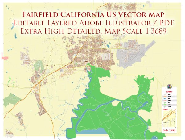
General overview of the history of urban development in Fairfield, California. Please note that developments may have occurred since then, so it’s advisable to check more recent sources for the latest information.
Fairfield is a city located in Solano County, California, in the northeastern part of the San Francisco Bay Area. Here is a brief historical overview of its urban development:
- Early Settlement and Agriculture (19th Century): The area that is now Fairfield was initially settled during the mid-19th century as part of the expansion of European-American settlers in California. The region was primarily agricultural, with farming and ranching playing significant roles in the local economy.
- Railroad and Growth (Late 19th Century): The arrival of the railroad in the late 19th century, with the completion of the California Pacific Railroad, contributed to the growth of Fairfield. The railroad facilitated the transportation of goods and people, encouraging economic development.
- Military Presence (20th Century): During World War II, Fairfield became home to Travis Air Force Base, which was established in 1942. The presence of the military base significantly influenced the city’s development, bringing economic opportunities and a growing population.
- Post-War Suburbanization (Mid-20th Century): Like many other cities in the United States, Fairfield experienced suburbanization in the post-World War II era. This period saw an increase in residential development, as well as the establishment of schools, shopping centers, and other amenities to accommodate the growing population.
- Economic Diversification (Late 20th Century): Fairfield continued to grow and diversify its economy in the latter half of the 20th century. The city saw the development of industrial and commercial areas, contributing to a more varied economic landscape.
- Population Growth and Modern Development (21st Century): In the 21st century, Fairfield continued to experience population growth and further urban development. The city has expanded its infrastructure, services, and amenities to meet the needs of a diverse and growing community.
Throughout its history, Fairfield has evolved from a predominantly agricultural community to a more diversified urban center. The presence of Travis Air Force Base and its strategic location between Sacramento and San Francisco has played a crucial role in shaping the city’s development. It’s worth noting that ongoing urban development initiatives, economic trends, and community priorities will continue to influence Fairfield’s growth in the future.


 Author: Kirill Shrayber, Ph.D. FRGS