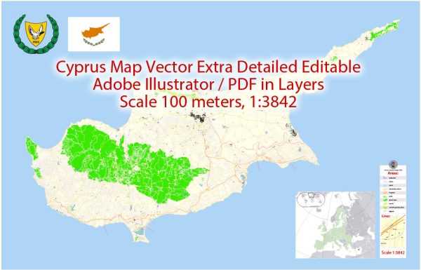
Cyprus, with its rich history and strategic location at the crossroads of Europe, Asia, and Africa, has experienced a diverse and complex urban development over the centuries. The island’s urban history can be traced back to ancient times, and various civilizations have left their mark on its cities.
- Ancient Period:
- Cypro-Archaic and Cypro-Classical Periods (750-310 BCE): During this time, cities like Kition (modern-day Larnaca) and Salamis (near Famagusta) flourished. These cities were important centers for trade and culture.
- Hellenistic Period (310-30 BCE): The influence of Hellenistic culture is evident in the architecture and layout of cities. Palaepaphos (modern-day Kouklia) and Nea Paphos (modern-day Paphos) became significant urban centers during this period.
- Roman Period (30 BCE – 330 CE):
- The Romans further developed existing cities and established new ones. The city of Salamis continued to thrive, and its ruins are a testament to the grandeur of Roman urban planning.
- Byzantine Period (330-1191):
- With the spread of Christianity, Byzantine influence shaped urban development. Nicosia, the island’s capital, became a prominent center during this period. Churches and monasteries were constructed, leaving a lasting impact on the urban landscape.
- Medieval Period (1191-1489):
- The island came under Frankish rule during the Crusades, and the Lusignan dynasty established their capital in Nicosia. Defensive structures, such as city walls and fortifications, were built during this time to protect against invasions.
- Venetian Period (1489-1571):
- The Venetians fortified coastal cities like Famagusta and Kyrenia to defend against Ottoman expansion. These fortifications are still visible today and are integral to the island’s architectural heritage.
- Ottoman Period (1571-1878):
- Ottoman rule significantly influenced urban development. Mosques, hammams (bathhouses), and markets were constructed, contributing to the Ottoman architectural style. Nicosia, Famagusta, and Larnaca were important administrative and commercial centers.
- British Colonial Period (1878-1960):
- The British introduced modern infrastructure, including railways and roads, influencing urbanization. Nicosia continued to be a hub of administrative activity.
- Post-Independence (1960-Present):
- After gaining independence in 1960, urbanization continued, especially in response to economic growth and population expansion. The island’s division in 1974 following the Turkish invasion has influenced urban development patterns, with cities like Nicosia and Famagusta being divided.
Throughout its history, Cyprus has been a melting pot of cultures, and this diversity is reflected in its urban development. The island’s cities bear witness to the ebb and flow of different civilizations, each leaving its imprint on the landscape and contributing to the unique character of Cyprus.


 Author: Kirill Shrayber, Ph.D. FRGS