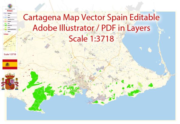
Cartagena, located on the southeastern coast of Spain in the Region of Murcia, has a rich history of urban development that spans over two millennia. Its strategic location along the Mediterranean coast has made it a key port and trading hub, resulting in a city with a diverse and layered history.
- Ancient Origins: The city’s history can be traced back to its foundation by the Carthaginians in 227 BC, who named it “Qart Hadasht” (New City). Carthage established the city as a key naval and military base. During the Punic Wars, it was a vital center for Carthaginian operations in the Iberian Peninsula.
- Roman Period: After the Second Punic War, the city was conquered by the Romans in 209 BC. They renamed it “Carthago Nova” and developed it into a major Roman port and trade center. The Roman influence is still evident in the well-preserved Roman Theater of Cartagena, which is one of the city’s most famous archaeological sites.
- Byzantine and Visigothic Rule: After the fall of the Western Roman Empire, Cartagena was briefly under Byzantine control and then came under the Visigothic kingdom. This period was marked by a decline in the city’s importance.
- Islamic Rule: In the early 8th century, Cartagena fell to the Moors, who ruled it until the 13th century. During this time, the city became known as “Qartayannat al-Halfa.” The Moorish influence can still be seen in the city’s architecture and layout.
- Reconquista and Christian Rule: Cartagena was reconquered by the Christians in the 13th century, and it became part of the Kingdom of Castile. It regained its significance as a trading port, especially during the Age of Exploration.
- Modern Era: In the 18th century, Cartagena underwent significant urban development, with the construction of military fortifications and walls, which are still visible in the city today. The city played a crucial role in Spain’s maritime history during this time.
- Contemporary Development: Cartagena continued to grow and evolve as an important naval and industrial city in the 19th and 20th centuries. The city’s urban development included the expansion of its port facilities and the construction of modern infrastructure.
Today, Cartagena is a vibrant and historically rich city that showcases its diverse heritage through its architecture, museums, and archaeological sites. The city’s urban development has balanced the preservation of its historical past with the requirements of modern life, making it a captivating destination for visitors interested in history, culture, and maritime heritage.


 Author: Kirill Shrayber, Ph.D. FRGS