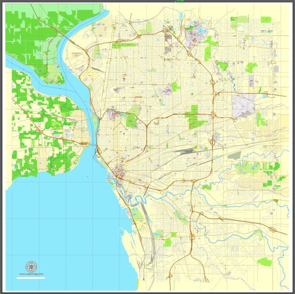
The history of urban development in Buffalo, New York, is a fascinating and complex story that spans centuries. Here’s a brief overview of the city’s urban development history:
- Early Settlement and Erie Canal: Buffalo’s history as a city begins with its strategic location at the eastern end of Lake Erie. The construction of the Erie Canal, which connected the Great Lakes to the Hudson River and New York City, in the early 19th century played a pivotal role in Buffalo’s growth. The city quickly became a major transportation and industrial hub due to its proximity to the canal.
- Industrialization and Growth: During the 19th century, Buffalo’s industrial base expanded significantly, with industries such as grain milling, steel production, and manufacturing flourishing. The city’s waterfront became a bustling port, and it was often referred to as the “Queen City of the Great Lakes.”
- Architectural Heritage: Buffalo boasts a rich architectural heritage, with various architectural styles from different eras. Prominent architectural gems include the Richardson Olmsted Campus (formerly the Buffalo State Hospital), the Guaranty Building, and the Darwin D. Martin House, all designed by renowned architects.
- Parks and Parkways: Buffalo is known for its park system, designed by Frederick Law Olmsted, who also designed New York City’s Central Park. The system includes Delaware Park, South Park, and the extensive parkway system, which adds to the city’s green spaces and natural beauty.
- 20th Century Urban Challenges: Like many Rust Belt cities, Buffalo faced challenges in the 20th century. Deindustrialization, suburbanization, and population decline affected the city’s economy and urban landscape. The construction of the Kensington Expressway also disrupted neighborhoods.
- Revitalization Efforts: In recent decades, Buffalo has experienced a resurgence in its urban development. Efforts have been made to revitalize the city’s waterfront, including the redevelopment of Canalside and the construction of the HarborCenter. The Buffalo Niagara Medical Campus has also been a key driver of economic growth.
- Historic Preservation: Buffalo has placed an emphasis on preserving its historic architecture and neighborhoods. The Allentown Historic District and Elmwood Village are examples of areas where historic character has been maintained.
- Cultural and Arts Scene: Buffalo has a thriving cultural and arts scene, with institutions such as the Albright-Knox Art Gallery, Shea’s Performing Arts Center, and the Buffalo Philharmonic Orchestra contributing to the city’s cultural vibrancy.
- Challenges and Opportunities: Buffalo continues to face challenges such as poverty, economic disparities, and infrastructure needs. However, the city’s development efforts, educational institutions, and healthcare facilities are positioning it for a more prosperous future.
Buffalo’s urban development history is a testament to its resilience and ability to adapt to changing circumstances over the years. As the city continues to evolve, it maintains a unique blend of historical character and modern vitality.


 Author: Kirill Shrayber, Ph.D. FRGS