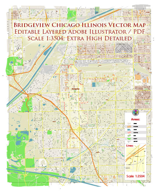
Bridgeview, Illinois, is a suburb located in the Chicago metropolitan area in the United States. Like many suburban areas, its development is closely tied to the history of urban development in Chicago. Here’s an overview of the history of urban development in Bridgeview and its relationship to Chicago:
- Early Settlement: Bridgeview was originally settled by European immigrants in the 19th century, with many of the earliest residents coming from Germany and Poland. The area was primarily agricultural and sparsely populated during this time.
- Impact of Railroads: The late 19th and early 20th centuries brought significant changes to the region, thanks to the expansion of railroads. The railroads facilitated the transportation of goods and people and played a crucial role in the industrialization of Chicago and its suburbs, including Bridgeview.
- Post-World War II Suburban Growth: Like many suburban areas in the United States, Bridgeview experienced significant growth in the post-World War II period. The availability of land and improved transportation infrastructure, such as highways, contributed to the suburbanization of the region. This growth was part of a nationwide trend as people moved from cities to the suburbs in search of more space and a different lifestyle.
- Industrial Development: Bridgeview, like other suburban areas, saw the development of industrial and commercial sectors during this period. The availability of land and proximity to major transportation routes made it an attractive location for businesses.
- Residential Expansion: The 1950s and 1960s saw a substantial increase in residential development in Bridgeview. Subdivisions and housing developments were constructed to accommodate the growing population, largely composed of families looking for suburban living near the job opportunities of Chicago.
- Sports and Entertainment: Bridgeview became known for its Toyota Park (now SeatGeek Stadium) development, a sports and entertainment venue that opened in 2006. It became home to Major League Soccer’s Chicago Fire and hosted various events, contributing to the local economy and the town’s identity.
- Commercial Growth: Over the years, Bridgeview has seen the development of commercial areas, shopping centers, and businesses, further enhancing its role as a suburban community.
- Infrastructure and Transportation: Bridgeview’s proximity to major highways, including I-294, I-55, and I-57, has made it an attractive location for businesses and residents looking for easy access to the city of Chicago and the surrounding suburbs.
- Contemporary Development: Today, Bridgeview continues to develop and evolve as part of the greater Chicago metropolitan area. It remains a diverse and growing community with a mix of residential, commercial, and industrial areas.
In summary, Bridgeview’s history of urban development is closely linked to the broader trends of suburbanization that occurred in the post-World War II period in the United States. Its location near Chicago and its access to transportation networks have played a significant role in shaping its development over the years, making it a thriving suburb in the Chicago metropolitan area.


 Author: Kirill Shrayber, Ph.D. FRGS