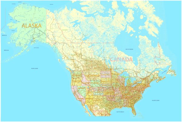
The United States and Canada are home to a vast number of lakes, many of which are significant in terms of size, natural beauty, and recreational opportunities. Here are descriptions of some of the main lakes in both countries:
Lakes in the United States:
- Lake Superior: Lake Superior is the largest of the Great Lakes and the largest freshwater lake by surface area in the world. It is located on the border of the United States (Minnesota, Wisconsin, and Michigan) and Canada (Ontario). The lake is known for its stunning scenery, clear waters, and opportunities for boating, fishing, and hiking.
- Lake Michigan: Lake Michigan is the second-largest of the Great Lakes and is entirely located within the United States. It is bordered by the states of Michigan, Wisconsin, Illinois, and Indiana. The lake is known for its sandy beaches, vibrant waterfront cities like Chicago, and recreational activities.
- Lake Huron: Lake Huron is the third-largest of the Great Lakes and straddles the border between the United States (Michigan) and Canada (Ontario). It offers a mix of natural beauty and outdoor recreation, with many islands, lighthouses, and opportunities for boating and fishing.
- Lake Erie: Lake Erie is the fourth-largest of the Great Lakes and is surrounded by the states of Ohio, Pennsylvania, New York, and Michigan, as well as the province of Ontario in Canada. It’s known for its shallow waters, which make it the warmest and most biologically productive of the Great Lakes. Lake Erie provides a range of recreational activities, including swimming, fishing, and boating.
- Great Salt Lake: Located in the state of Utah, the Great Salt Lake is the largest saltwater lake in the Western Hemisphere. It’s known for its high salinity, unique ecosystems, and is a popular destination for birdwatching and sailing.
Lakes in Canada:
- Lake Ontario: Lake Ontario is the easternmost of the Great Lakes and is bordered by the Canadian province of Ontario and the U.S. state of New York. It’s the smallest of the Great Lakes but is still a significant body of water, offering recreational activities and beautiful scenery along its shores.
- Lake Winnipeg: Located in Manitoba, Canada, Lake Winnipeg is one of the largest freshwater lakes in North America. It is known for its diverse ecosystems, including beaches, wetlands, and forests, making it a popular destination for outdoor enthusiasts.
- Great Bear Lake: Situated in Canada’s Northwest Territories, Great Bear Lake is the largest entirely within Canada and one of the largest in the world. It’s known for its pristine waters, abundant fish populations, and remote wilderness, making it a popular spot for fishing and wilderness adventures.
- Great Slave Lake: Another significant lake in the Northwest Territories, Great Slave Lake is the second-largest lake entirely within Canada. It’s a vital transportation route, rich in fish, and offers opportunities for boating, camping, and wildlife viewing.
These are just a few of the prominent lakes in the United States and Canada. Both countries boast many more lakes, each with its unique characteristics and attractions.

 Author: Kirill Shrayber, Ph.D. FRGS