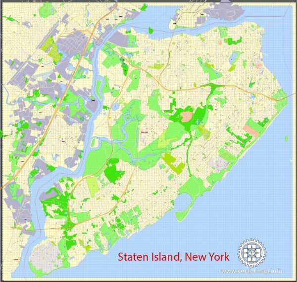
Staten Island, one of the five boroughs of New York City, is an important location for the maritime industry and transportation within the United States. Situated in the southwest part of the city, Staten Island boasts a strategic geographical position that has historically made it a hub for maritime activities, as well as a key component of the transportation network in the region. Here’s a description of the maritime industry and transportation on Staten Island:
- Port Facilities: Staten Island is home to several major port facilities that play a critical role in the maritime industry. The most prominent of these is the Port of New York and New Jersey, which is one of the largest and busiest ports in the United States. It includes various terminals and piers that handle a wide range of cargo, including containers, bulk commodities, and general cargo.
- Cargo Handling: The port facilities on Staten Island are equipped with state-of-the-art cargo handling equipment and infrastructure to efficiently load and unload vessels. Container terminals, warehouses, and intermodal rail connections are available to facilitate the smooth movement of goods.
- Transportation Infrastructure: Staten Island is connected to the rest of New York City and New Jersey via several transportation links. The Staten Island Ferry provides a vital commuter link to Manhattan and serves as a scenic route for passengers to enjoy stunning views of the Statue of Liberty and the Manhattan skyline.
- Staten Island Rail: The Staten Island Railway is a freight and passenger rail line that operates on the island. It connects with the New York City subway system at the St. George Terminal, making it a key transportation link for both residents and businesses.
- Road Network: Staten Island is connected to the mainland via several bridges, including the Verrazzano-Narrows Bridge, the Goethals Bridge, and the Bayonne Bridge. These bridges allow the flow of goods and people between Staten Island and the neighboring regions of New York and New Jersey.
- Industrial Zones: Staten Island has various industrial zones and waterfront areas where manufacturing and logistics businesses are located. These areas support the maritime industry by providing space for warehouses, distribution centers, and facilities for processing and storing goods.
- Maritime Services: Numerous maritime service providers operate on Staten Island, including ship repair and maintenance facilities, ship supply companies, and maritime law firms. These services are essential for the smooth operation of the maritime industry.
- Environmental Concerns: The maritime industry on Staten Island, like many others, faces environmental challenges related to pollution, waste management, and sustainability. Efforts are being made to reduce the environmental impact and promote sustainability in the maritime sector.
Staten Island’s maritime industry and transportation network are essential components of the greater New York City metropolitan area. The strategic location of the island, its port facilities, and its transportation infrastructure make it a crucial hub for the movement of goods and people, contributing significantly to the regional and national economy.


 Author: Kirill Shrayber, Ph.D.