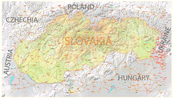
Slovakia is home to several beautiful national parks that offer a diverse range of natural landscapes and outdoor activities. Here are brief descriptions of some of the prominent national parks in Slovakia:
- High Tatras National Park (Tatranský národný park):
- Located in the northern part of Slovakia, the High Tatras National Park is the oldest national park in the country and is known for its stunning alpine scenery.
- The park is characterized by rugged mountains, deep valleys, glacial lakes, and diverse flora and fauna.
- It offers excellent hiking and mountaineering opportunities, including the ascent of Slovakia’s highest peak, Gerlachovský štít.
- Visitors can also enjoy winter sports like skiing and snowboarding in the park’s snow-covered landscapes.
- Slovak Paradise National Park (Slovenský raj):
- Slovak Paradise is known for its unique and intricate network of gorges, canyons, and forests.
- The park is famous for its hiking trails that often involve wooden ladders, walkways, and suspension bridges, allowing visitors to explore the park’s dramatic terrain.
- Waterfalls, caves, and natural rock formations make this park a paradise for outdoor enthusiasts and nature lovers.
- Low Tatras National Park (Národný park Nízke Tatry):
- Situated in central Slovakia, the Low Tatras National Park offers a more gentle and rolling terrain compared to the High Tatras.
- The park is known for its extensive forests, meadows, and a variety of wildlife, including brown bears, lynx, and chamois.
- Outdoor activities such as hiking, biking, and winter sports are popular here.
- Pieniny National Park (Pieninský národný park):
- Located in the north of Slovakia, Pieniny National Park is renowned for its scenic beauty and the picturesque Dunajec River Gorge.
- The park’s highlights include rafting along the Dunajec River and exploring the limestone formations, castles, and traditional architecture of the region.
- Muránska Planina National Park:
- Situated in central Slovakia, this park is known for its extensive karst plateaus and meadows.
- It offers excellent opportunities for hiking, cycling, and enjoying the unspoiled nature and wildlife.
- Poloniny National Park (Národný park Poloniny):
- Located in the eastern part of Slovakia, Poloniny National Park is known for its primeval beech forests and the protection of the Carpathian Biosphere Reserve.
- The park offers a unique opportunity to experience the untouched beauty of Eastern Carpathian landscapes.
These national parks in Slovakia provide a diverse range of outdoor activities, from hiking and wildlife-watching to winter sports, making them a popular destination for nature enthusiasts and adventurers. They offer a chance to explore the natural beauty and rich biodiversity of this European country.


 Author: Kirill Shrayber, Ph.D. FRGS