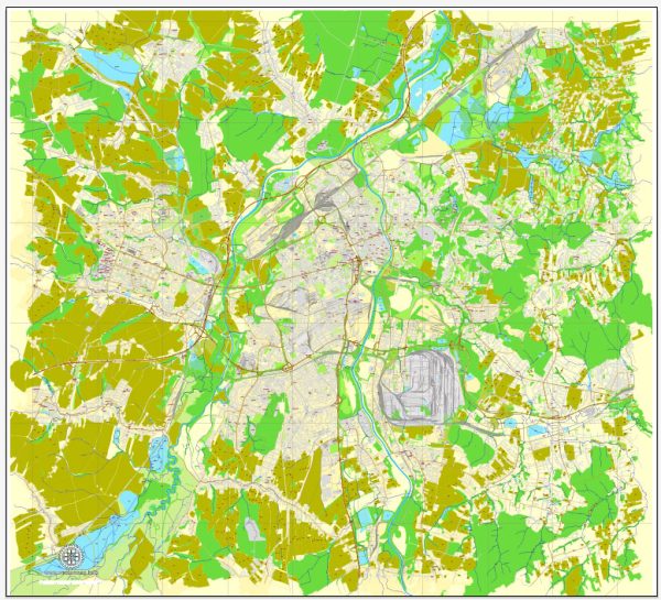
Ostrava is a city located in the northeastern part of the Czech Republic, and while it is primarily an industrial and urban center, it is surrounded by several beautiful nature parks and natural areas that offer a respite from the hustle and bustle of city life. Here are some of the nature parks and areas around Ostrava:
- Beskydy Mountains: The Beskydy Mountains are a picturesque range of mountains located to the east of Ostrava. These mountains offer a range of outdoor activities, including hiking, mountain biking, and winter sports. The pristine forests, rolling hills, and charming villages make it a popular destination for nature lovers.
- Poodří Protected Landscape Area: This protected landscape area is situated along the Ostravice River and the Odra River, providing a unique environment for wetland flora and fauna. It’s an excellent place for birdwatching and enjoying the tranquility of nature. There are several hiking and biking trails within the area.
- Ostravice River: The Ostravice River flows through the Beskydy Mountains and offers opportunities for water sports, fishing, and scenic walks along its banks. The riverbanks are lined with lush vegetation and provide a peaceful escape from the city.
- Černá louka (Black Meadow): Located in the heart of Ostrava, Černá louka is a large city park that features a variety of landscapes, including grassy meadows, ponds, and wooded areas. It’s an excellent place for a leisurely stroll, picnicking, or simply enjoying the greenery within the city.
- Slezskoostravský hrad (Silesian-Ostrava Castle) Park: This park surrounds the Silesian-Ostrava Castle and provides a pleasant area for a walk or a relaxing afternoon. It also includes a small lake and a children’s playground.
- Landek Park: Landek Park is a former coal mine turned into an industrial heritage and nature park. It offers a unique blend of history and nature, with walking trails, mining exhibitions, and panoramic views of the surrounding landscape.
These natural areas and parks provide a diverse range of outdoor activities and recreational opportunities for both residents and visitors to Ostrava. Whether you’re interested in hiking, wildlife observation, or simply enjoying the beauty of the outdoors, Ostrava and its surrounding regions offer a variety of options to connect with nature.


 Author: Kirill Shrayber, Ph.D. FRGS