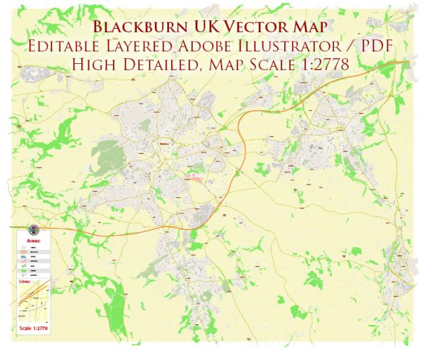
Blackburn, a town in Lancashire, England, offers several beautiful nature parks and green spaces where residents and visitors can enjoy the outdoors, relax, and connect with nature. Here are some of the notable nature parks in Blackburn:
- Witton Country Park: Witton Country Park is one of the largest and most popular parks in Blackburn. It spans over 480 acres and offers a range of outdoor activities. The park features woodlands, meadows, a large reservoir, and a network of walking and cycling trails. It’s an excellent place for picnics, birdwatching, and wildlife spotting.
- Roe Lee Park: Located in the east of Blackburn, Roe Lee Park is a smaller but well-maintained green space. It has a play area for children, tennis courts, and a pond, making it a great place for family outings and leisurely walks.
- Corporation Park: Corporation Park is a historic park with beautifully landscaped gardens, tree-lined avenues, and a picturesque boating lake. It also houses a conservatory, a café, and an ornate bandstand. This park is perfect for a leisurely stroll or a quiet afternoon enjoying the greenery.
- Darwen Tower and Sunnyhurst Wood: Just a short drive from Blackburn, Sunnyhurst Wood is a tranquil nature reserve with walking trails, woodlands, and a picturesque waterfall. The highlight of the area is Darwen Tower, a Victorian-era tower that offers panoramic views of the surrounding countryside.
- Bold Venture Park: Located in Darwen, close to Blackburn, Bold Venture Park is a spacious green area with a children’s playground, bowling greens, and tennis courts. It’s an ideal spot for a family day out or a relaxing walk.
- Canal and Riverside Walks: Blackburn is intersected by the Leeds and Liverpool Canal and several rivers. These waterways offer pleasant walks, ideal for both leisurely strolls and more extended hikes. The canal and riverside paths are perfect for observing wildlife and enjoying a peaceful waterside atmosphere.
- Turton and Entwistle Reservoir: A bit further away from Blackburn but within driving distance, Turton and Entwistle Reservoir is a serene spot for birdwatching and walking. The surrounding moorland and woodlands provide ample opportunities for exploration.
These nature parks and green spaces in Blackburn and its surrounding areas offer a variety of outdoor experiences, from peaceful walks to recreational activities. They provide a welcome escape from the urban hustle and bustle and a chance to connect with the natural beauty of the region.


 Author: Kirill Shrayber, Ph.D. FRGS