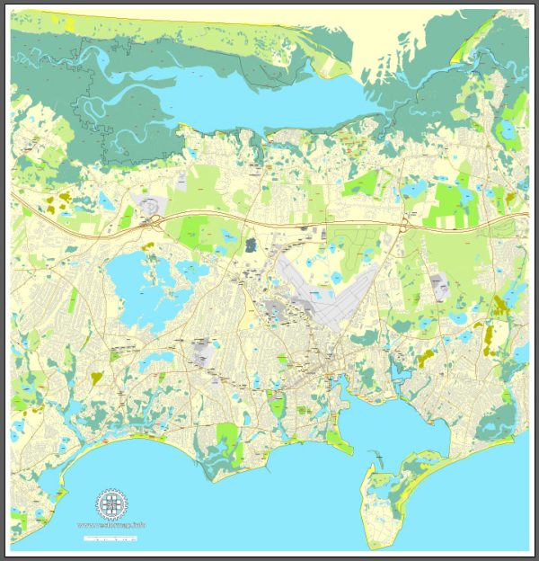
Barnstable, Massachusetts, is a beautiful town located on Cape Cod, and it offers several nature parks and outdoor recreational areas where visitors and residents can connect with nature and enjoy the natural beauty of the region. Here are some of the notable nature parks in Barnstable:
- Sandy Neck Beach Park: This park is one of Barnstable’s most popular destinations, featuring a stunning barrier beach that stretches for six miles along Cape Cod Bay. Visitors can enjoy swimming, hiking, birdwatching, and off-road vehicle (ORV) adventures. The park is also home to diverse wildlife and has extensive dune systems.
- Barnstable Harbor: Located on the northern side of the Cape, Barnstable Harbor offers opportunities for boating, fishing, and birdwatching. It’s a great spot to enjoy the scenic beauty of the harbor and explore the marshes and tidal flats.
- Long Pasture Wildlife Sanctuary: Managed by the Massachusetts Audubon Society, this sanctuary is an excellent place for hiking and wildlife observation. It offers a variety of habitats, including salt marshes, woodlands, and meadows. Guided nature walks and educational programs are available for visitors.
- Blish Point: This small, quiet park is situated on the shores of Barnstable Harbor and provides excellent views of the harbor, marshes, and tidal flats. It’s a peaceful place for a leisurely walk and birdwatching.
- Cape Cod Pathways: Barnstable is part of the larger Cape Cod Pathways trail network, which offers an extensive system of trails that wind through woodlands, salt marshes, and coastal landscapes. These trails are perfect for hiking and nature exploration.
- Lowell Park: While primarily a baseball park, Lowell Park also has a beautiful pond and walking trails surrounding it, making it a nice spot for a leisurely walk in a more urban setting.
- Cape Cod Maritime Museum: This museum, though not a traditional nature park, is dedicated to preserving and celebrating the rich maritime history of Cape Cod. It’s an informative and interesting place to learn about the region’s connection to the sea.
Barnstable’s natural beauty and recreational opportunities make it a fantastic place for outdoor enthusiasts and nature lovers to explore and enjoy the diverse ecosystems and landscapes that Cape Cod has to offer. Whether you’re interested in birdwatching, hiking, or simply taking in the coastal scenery, Barnstable has something to offer everyone.


 Author: Kirill Shrayber, Ph.D. FRGS