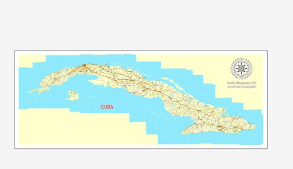
Cuba, the largest island in the Caribbean, has a diverse and fascinating geology that reflects its complex geological history. Here is a brief description of Cuba’s geology:
- Tectonic Setting: Cuba is located at the boundary of the North American and Caribbean tectonic plates. This tectonic setting has had a significant influence on the island’s geology, leading to the formation of various geological features.
- Geological History: The geological history of Cuba is characterized by a series of tectonic events, including the collision of the North American and Caribbean plates. These events have led to the formation of mountain ranges, sedimentary basins, and various geological structures on the island.
- Mountain Ranges: The most prominent geological feature in Cuba is the Sierra Maestra mountain range, which runs along the southeastern part of the island. These mountains are of volcanic origin and were formed as a result of tectonic activity. Pico Turquino, the highest peak in Cuba, is located in the Sierra Maestra.
- Karst Topography: Cuba is also known for its extensive karst topography, characterized by limestone formations, sinkholes, and cave systems. The Viñales Valley in western Cuba is a UNESCO World Heritage site famous for its distinctive karst landscape.
- Sedimentary Basins: Several sedimentary basins can be found in Cuba, including the Cauto Basin and the Zapata Peninsula. These basins have been the focus of oil and gas exploration, and they contain important fossil deposits.
- Mineral Resources: Cuba has significant mineral resources, including nickel, cobalt, and various industrial minerals. Nickel mining is a major industry in the country, with the Moa region being a notable nickel mining area.
- Coastal Geology: Cuba’s coastline is diverse, with sandy beaches, mangroves, and coral reefs. The island is surrounded by some of the most extensive coral reef systems in the Caribbean, making it a popular destination for divers and marine enthusiasts.
- Seismic Activity: Cuba is located in a seismically active region due to its position near the boundary of tectonic plates. The country can experience occasional earthquakes and is vulnerable to seismic hazards.
- Fossils: Cuba has rich fossil deposits, particularly in the sedimentary rock formations. These fossils provide valuable insights into the island’s geological history and past environments.
In summary, Cuba’s geology is a product of its tectonic location at the boundary of two major plates, resulting in diverse geological features such as mountain ranges, karst landscapes, sedimentary basins, and rich mineral resources. The island’s geological history is a complex story of geological processes and events that have shaped its unique landscape.


 Author: Kirill Shrayber, Ph.D.