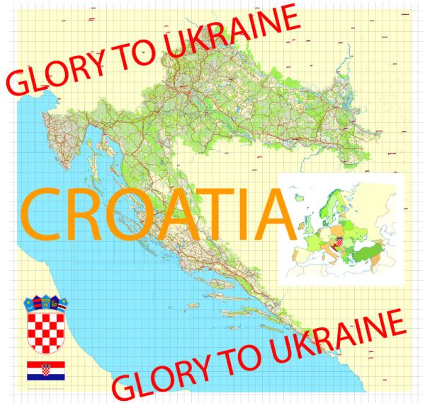
Croatia, located in Southeastern Europe, is known for its beautiful landscapes and abundant water resources. The country boasts a diverse network of rivers, lakes, and a stunning coastline along the Adriatic Sea. Here are some key points about Croatia’s water resources and bridges:
- Rivers: Croatia is crossed by several major rivers, including the Sava, Drava, Kupa, and Una. The Sava River, which flows through the capital city, Zagreb, is one of the most important rivers in the country. These rivers play a significant role in the country’s water resources, providing water for agriculture, transportation, and energy production.
- Lakes: Croatia is famous for its numerous lakes, with Plitvice Lakes National Park being a prime example. Plitvice Lakes is a UNESCO World Heritage site, known for its cascading waterfalls and crystal-clear lakes. The country has other notable lakes, such as Lake Vrana and Lake Jarun.
- Adriatic Sea: Croatia has a long and picturesque coastline along the Adriatic Sea, providing access to the sea for trade, tourism, and fisheries. The coast is dotted with numerous islands, making it a popular destination for sailing and water sports.
- Bridges: Croatia has a substantial number of bridges, ranging from small rural crossings to major urban bridges. Some of the most famous bridges in the country include:
a. Franjo Tuđman Bridge: Located in the city of Dubrovnik, this cable-stayed bridge connects the mainland to the Pelješac Peninsula.
b. Maslenica Bridge: This bridge spans the Novsko Ždrilo strait and connects the northern and southern parts of Croatia.
c. Krk Bridge: It connects the island of Krk to the mainland, making it the largest bridge in Croatia.
d. Šibenik Bridge: Located in Šibenik, this bridge is a significant transportation link in the region.
- Historical Bridges: Croatia also has numerous historical bridges, especially in cities with rich cultural heritage. These bridges often serve as important landmarks and attractions. For example, the Stari Most in Mostar, Bosnia and Herzegovina, is a famous arched bridge near the Croatian border.
Croatia’s water resources and bridges are integral to its cultural, economic, and natural landscapes, contributing to the country’s beauty and functionality. The country’s government has been investing in the maintenance and development of its infrastructure to ensure the sustainability of these valuable resources and transportation links.


 Author: Kirill Shrayber, Ph.D. FRGS