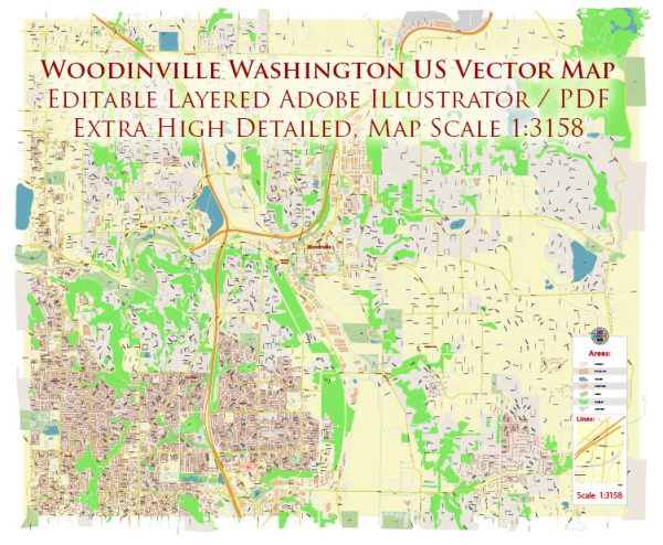
Woodinville, Washington, is a city located in King County in the United States. It is part of the greater Seattle metropolitan area and is known for its scenic beauty and proximity to wineries and outdoor recreational opportunities. Water resources and bridges in the area play a significant role in its infrastructure and natural beauty.
- Sammamish River: The Sammamish River flows through Woodinville and is a key water resource in the area. It originates from Lake Sammamish to the north and joins the larger Lake Washington to the south. This river is a popular spot for recreational activities like kayaking and fishing.
- Bridges: Woodinville has several bridges that span the Sammamish River and other water bodies. These bridges are important for transportation and connectivity in the region. Notable bridges in and around Woodinville include:
- Woodinville-Redmond Road Bridge: This bridge spans the Sammamish River and connects Woodinville to the neighboring city of Redmond. It is an important transportation link in the area.
- NE 175th Street Bridge: This bridge is another significant structure in Woodinville, crossing the Sammamish River and connecting the city with Redmond.
- Tolt Pipeline Trail Bridge: The Tolt Pipeline Trail, a popular recreational trail in the area, includes a bridge that spans the Sammamish River. It provides a scenic route for hikers and cyclists and offers beautiful views of the river.
- Cottage Lake Park Bridge: Located in the nearby Cottage Lake Park, this bridge crosses Cottage Lake and is an important part of the park’s trail system.
- Water Resources Management: The management of water resources in Woodinville, like many other areas in the Pacific Northwest, is crucial for maintaining water quality and ensuring a sustainable water supply. The city and surrounding region are committed to preserving and protecting their water resources.
Please note that the specific details and conditions of these water resources and bridges may change over time due to maintenance, development, or other factors. It’s advisable to consult local authorities and resources for the most up-to-date information regarding water resources and bridge infrastructure in Woodinville, Washington.


 Author: Kirill Shrayber, Ph.D. FRGS