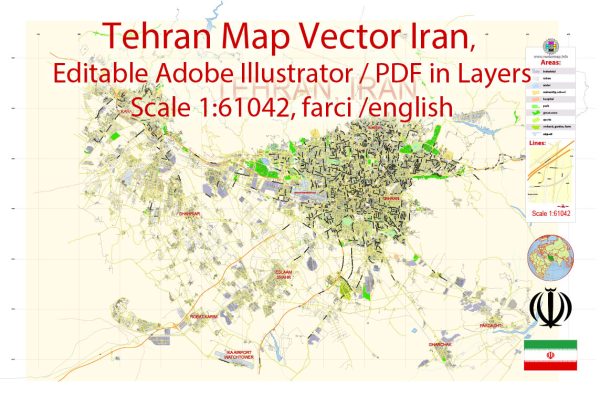
Tehran, the capital of Iran, is a vast and diverse metropolis divided into several districts and neighborhoods, each with its unique characteristics and cultural vibes. General overview of some of Tehran’s districts and neighborhoods.
- Tehran City Center (Shahre Rey):
- Tajrish: Located in the north of Tehran, it’s a historic and affluent neighborhood known for its bazaar, parks, and the beautiful Tajrish Square.
- Sa’adat Abad: An upscale district with many embassies, foreign schools, and shopping centers.
- Northern Tehran:
- Darband: A popular recreational area at the base of the Alborz Mountains, known for its hiking trails, restaurants, and cool climate.
- Gheytarieh: An upscale residential area with many modern apartments and houses.
- Western Tehran:
- Tajrish: In addition to being a historic district, Tajrish is also considered part of northern Tehran.
- Elahiyeh: An affluent neighborhood with luxury boutiques, restaurants, and foreign embassies.
- Southern Tehran:
- Shahr-e Ray: A historic area known for its bazaar and traditional architecture.
- Rey: The oldest part of Tehran, home to historical sites like Cheshmeh Ali and Rey Castle.
- Eastern Tehran:
- Shahr-e Ray: Also extends to the eastern part of Tehran.
- Jamaran: The location of the former residence of the late Ayatollah Khomeini, which is now a museum.
- Central Tehran:
- Baharestan: The political center of the city, housing the Iranian Parliament (Majlis) and many government offices.
- Laleh-Zar Street: Known for its shopping and business districts.
- Southern Tehran:
- Valiasr Street: One of the longest and most famous streets in Tehran, lined with shops, cafes, and cultural institutions.
- Javadiyeh: A residential area in the south known for its green spaces and parks.
- District 22 (Downtown Tehran):
- Enghelab Street: A vibrant and bustling area with numerous shops, restaurants, and cultural attractions.
- Ferdows Garden: Home to Ferdowsi University and various cultural and educational institutions.


 Author: Kirill Shrayber, Ph.D. FRGS