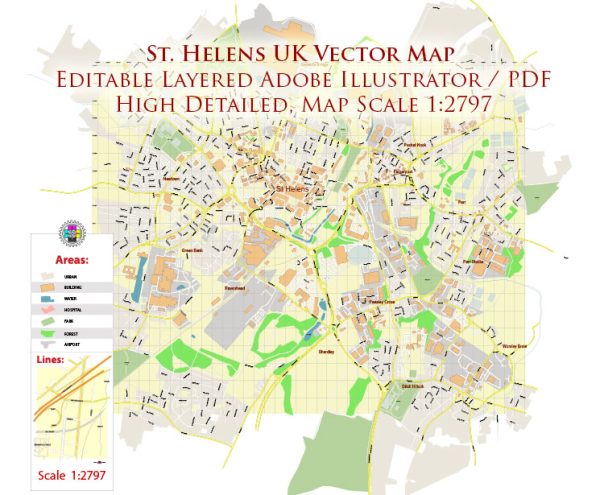
The St Helens area in the United Kingdom is located in the North West of England, within the ceremonial county of Merseyside. It has a diverse ecological landscape, encompassing urban areas, parks, woodlands, wetlands, and agricultural land. Here’s a general ecological description of the St Helens area:
- Urban Areas: St Helens itself is a town with urban development, including residential, commercial, and industrial zones. These areas have relatively limited ecological diversity due to human development and urbanization. However, there are pockets of green spaces and parks within the urban landscape, which provide some habitat for local wildlife.
- Parks and Green Spaces: The St Helens area has several parks and green spaces, including Taylor Park, Sherdley Park, and various smaller parks and gardens. These areas offer a range of ecosystems, from manicured lawns to wooded sections and bodies of water. They support diverse flora and fauna, including birds, insects, and small mammals.
- Woodlands: Some woodlands can be found in and around St Helens. These woodlands are typically a mix of native and non-native tree species. Common tree species in the region include oak, birch, and conifers. These woodlands support a variety of wildlife, including squirrels, birds, and insects.
- Wetlands and Water Bodies: The St Helens area has a few wetlands and water bodies, including streams, ponds, and reservoirs. These areas provide habitat for waterfowl, amphibians, and various aquatic plants. Eccleston Mere is one such example, and it is home to a variety of waterbirds.
- Agricultural Land: Surrounding St Helens are extensive areas of farmland, where various crops are grown, and livestock is raised. The type of agriculture can vary from arable farming to pastureland. These agricultural areas contribute to the region’s ecological diversity and support a variety of wildlife, including farmland birds.
- Conservation Areas: There may be designated conservation areas in and around St Helens that protect and preserve specific habitats or species. These areas are managed to maintain and enhance biodiversity.
- Threats and Conservation Efforts: Like many urban and suburban areas, St Helens faces challenges related to habitat loss, pollution, and invasive species. Conservation efforts may focus on preserving existing green spaces, restoring habitats, and creating wildlife corridors to connect fragmented ecosystems.
- Local Wildlife: Wildlife commonly found in the St Helens area includes a variety of birds (e.g., robins, sparrows, and wood pigeons), small mammals (e.g., rabbits and hedgehogs), and a range of insects and butterflies. Additionally, you may find waterfowl in wetland areas and fish in local water bodies.
It’s important to note that the specific ecological characteristics of the St Helens area may vary depending on the exact location within the town and its surroundings, as well as ongoing conservation efforts and land use changes. Conservation organizations and local authorities play a crucial role in maintaining and enhancing the ecological diversity of the region.


 Author: Kirill Shrayber, Ph.D. FRGS