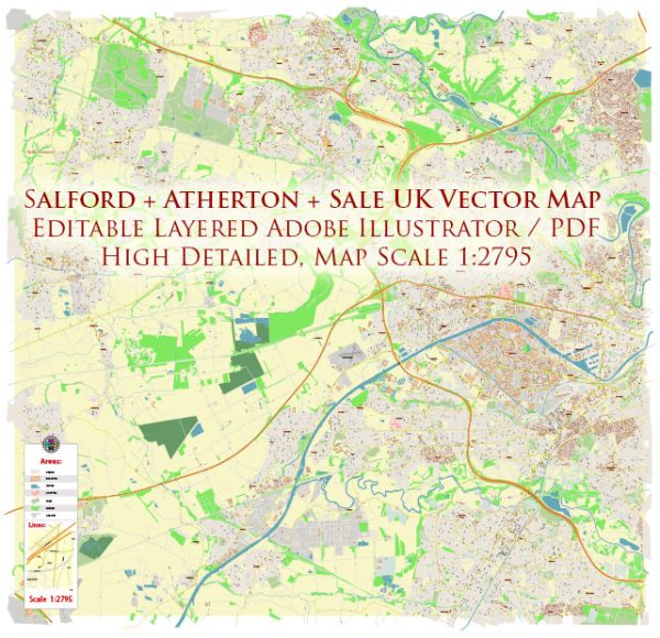
Salford is a city located in Greater Manchester, England. It is situated near the River Irwell and has a number of water resources and bridges within and around the city. Here are some key points about Salford’s water resources and bridges:
- River Irwell: The River Irwell flows through Salford and is a significant water resource for the city. It is a tributary of the River Mersey and has played a crucial role in the region’s history for transportation and trade.
- Salford Quays: Salford Quays is an area of Salford that has been extensively developed in recent years. It includes several water basins and canals that were once part of the Manchester Docks. Salford Quays is home to cultural and leisure facilities, including The Lowry, MediaCityUK, and the Imperial War Museum North.
- Bridges: Salford features several bridges that connect various parts of the city and provide essential transportation links. Some notable bridges include:
- MediaCityUK Footbridge: This footbridge connects MediaCityUK to other parts of Salford and offers scenic views of the waterfront.
- Millennium Bridge: The Millennium Bridge connects Salford Quays to Trafford, spanning the Manchester Ship Canal. It’s a pedestrian and cycle bridge and is an iconic structure in the area.
- Regent Road Bridge: This bridge crosses the River Irwell, connecting Salford to Manchester. It is an important transportation link for vehicles.
- Trafford Road Swing Bridge: This swing bridge also crosses the Manchester Ship Canal and allows ships to pass through. It’s a historic and functional piece of infrastructure.
These bridges are not only important for transportation but also contribute to the character and aesthetics of the city, especially in the waterfront areas like Salford Quays.
Salford’s water resources and bridges are an integral part of the city’s history, culture, and infrastructure, serving both functional and recreational purposes.


 Author: Kirill Shrayber, Ph.D.