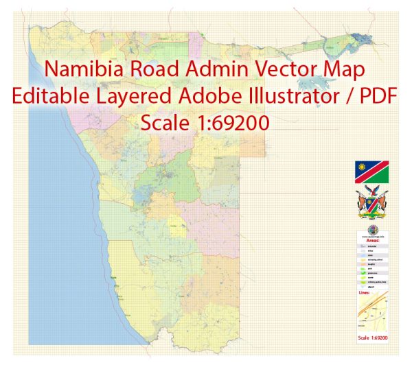
Namibia is divided into 14 administrative regions, each with its unique characteristics and geographical features. Here is a brief description of each administrative region in Namibia:
- Zambezi Region:
- Located in the far northeastern part of Namibia.
- Borders Zambia, Zimbabwe, and Botswana.
- Known for the Zambezi River and lush landscapes.
- Traditional cultures and ethnic groups, including the Lozi people.
- Kavango East Region:
- Situated in the northeastern part of Namibia.
- Features the Kavango River.
- Rich in biodiversity and wildlife, with national parks and game reserves.
- Dominated by the Kavango people.
- Kavango West Region:
- Neighboring the Kavango East Region.
- Also home to the Kavango River and its associated wildlife.
- Primarily inhabited by the Kavango people.
- Ohangwena Region:
- Located in the north of Namibia.
- Predominantly inhabited by the Ovambo people.
- Important agricultural and cultural region.
- Omusati Region:
- Situated in the northwest of Namibia.
- Known for its cultural heritage, including traditional homesteads and festivals.
- Home to the Ovambo people.
- Oshana Region:
- In the north-central part of Namibia.
- Contains the largest town in northern Namibia, Oshakati.
- Mainly inhabited by the Ovambo people.
- Oshikoto Region:
- Located in north-central Namibia.
- Rich in history and culture, with various historical sites.
- Home to the Aawambo people.
- Ohangwena Region:
- In the northern part of Namibia.
- Dominated by the Ovambo people.
- Known for its agriculture and traditional customs.
- Omaheke Region:
- Found in the eastern part of Namibia.
- Semi-arid region with diverse flora and fauna.
- Notable for its cattle farming and conservation areas.
- Otjozondjupa Region:
- Located in central Namibia.
- Home to the town of Otjiwarongo.
- Diverse landscapes, including the Waterberg Plateau National Park.
- Significant wildlife and tourism opportunities.
- Erongo Region:
- In the western part of Namibia.
- Features the coastal town of Swakopmund.
- Rich in minerals and natural beauty, including the Namib Desert and the Erongo Mountains.
- Kunene Region:
- In the northwestern part of Namibia.
- Known for its rugged and arid landscapes.
- Home to the Himba people and the stunning Epupa Falls.
- Oshikoto Region:
- Located in the north-central part of Namibia.
- Notable for its cultural heritage and historical sites.
- Predominantly inhabited by the Oshikwanyama people.
- Hardap Region:
- In the southern part of Namibia.
- Features the capital city, Windhoek.
- Diverse landscapes, from the Kalahari Desert to the Khomas Highland Plateau.
Each of these regions in Namibia has its unique characteristics, cultures, and attractions, making the country a diverse and culturally rich nation with a variety of landscapes and ecosystems.


 Author: Kirill Shrayber, Ph.D. FRGS