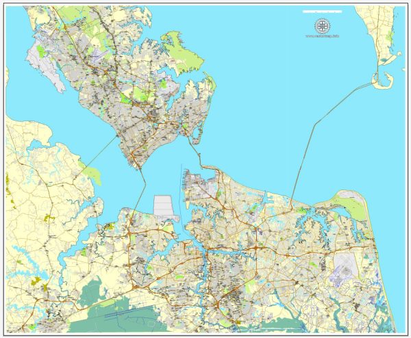
Hampton Roads is a region in Virginia, USA, that encompasses several cities and communities, including Hampton, Newport News, Norfolk, Chesapeake, Portsmouth, and Virginia Beach. The region is known for its extensive water resources, including a large natural harbor and various rivers, canals, and waterways. These water resources have a significant impact on transportation and the need for bridges and tunnels in the area. Here is some information about the water resources and bridges in Hampton Roads:
- Chesapeake Bay: Hampton Roads is located at the mouth of the Chesapeake Bay, a large estuary on the East Coast of the United States. The bay is a vital water resource for the region, supporting maritime commerce, recreation, and seafood industries.
- James River: The James River flows through Hampton Roads and plays a crucial role in the region’s history and economy. It is navigable and serves as a transportation route for shipping and commerce.
- Elizabeth River: The Elizabeth River is another significant waterway in the area, and it is known for its deepwater harbor. It flows through Norfolk and Portsmouth and is essential for the maritime industry.
- Interstate Waterways: Hampton Roads also features an intricate network of canals, channels, and bays that connect these major water bodies, facilitating shipping and boating.
Bridges and tunnels are essential to connect the various cities in the Hampton Roads region due to the prevalence of waterways. Some of the notable bridges and tunnels in the area include:
- Monitor-Merrimac Memorial Bridge-Tunnel: This tunnel-bridge combination crosses the Hampton Roads Harbor, connecting Newport News and Suffolk. It is a critical transportation link in the region.
- Hampton Roads Bridge-Tunnel: This complex system of bridges and tunnels connects Hampton and Norfolk, providing a vital link for travelers and commerce.
- Chesapeake Bay Bridge-Tunnel: Though not within the immediate vicinity of the cities listed, this famous bridge-tunnel combination connects Virginia’s Eastern Shore with the mainland and is a key part of the regional transportation network.
- Jordan Bridge: The Jordan Bridge spans the Southern Branch of the Elizabeth River, connecting Chesapeake and Portsmouth.
- Midtown Tunnel and Downtown Tunnel: These tunnels run beneath the Elizabeth River, connecting Norfolk and Portsmouth.
These bridges and tunnels are essential for the movement of people and goods throughout the Hampton Roads region, given the numerous water bodies that cut through the area. They help alleviate traffic congestion and facilitate the efficient flow of transportation.
Please note that the status and conditions of these water resources, bridges, and tunnels may change over time, so it’s advisable to consult local authorities or updated sources for the most current information.


 Author: Kirill Shrayber, Ph.D.