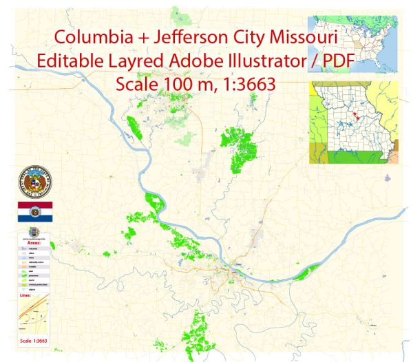
Columbia and Jefferson City are two cities located in the state of Missouri, USA, and they are both situated along the Missouri River, which is a significant water resource in the region. Here’s some information about water resources and bridges in these cities:
- Missouri River: The Missouri River is a major water resource in this region. It flows near both Columbia and Jefferson City. It serves as a source of water for various purposes, including drinking water, irrigation, and industrial use. It is also used for recreational activities like boating and fishing.
- Bridges in Columbia:
- Providence Road Bridge: This bridge crosses Hinkson Creek and is an essential transportation route in Columbia.
- I-70 Bridge: Columbia has multiple bridges that span Interstate 70, a major highway in the area.
- Bridges in Jefferson City:
- Missouri River Bridge (U.S. Route 54/63): This bridge connects Jefferson City to the neighboring area. It’s a crucial transportation link for the city and the region.
- Clark Avenue Bridge: This is another important bridge in Jefferson City, providing a key connection within the city.
Both cities have a network of smaller bridges that facilitate transportation and access to various parts of the cities. These bridges are essential for daily commuting, trade, and emergency services.
It’s important to note that my information is based on data available up to September 2021, and there may have been developments or changes related to water resources and bridges in Columbia and Jefferson City since that time. If you need the most current and detailed information, I would recommend reaching out to local government authorities or transportation departments in these cities.


 Author: Kirill Shrayber, Ph.D. FRGS