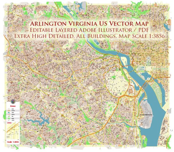
Arlington, Virginia, is a county located just across the Potomac River from Washington, D.C. As part of the Washington, D.C. metropolitan area, Arlington has an extensive and well-developed transportation system that includes various modes of transportation to serve the needs of its residents and visitors. Here are some key components of Arlington’s transportation system:
- Metrorail: Arlington is served by the Washington Metropolitan Area Transit Authority (WMATA) Metrorail system, which provides convenient access to Washington, D.C., and the surrounding region. Arlington has multiple Metrorail stations, including the Rosslyn, Courthouse, Clarendon, Virginia Square, Ballston, East Falls Church, and Pentagon City stations. The Metrorail connects Arlington to D.C., Maryland, and other parts of Northern Virginia.
- ART (Arlington Transit): The ART bus system serves Arlington County and provides transportation options within the county, connecting residents to Metrorail stations, bus transit centers, and popular destinations.
- Bicycling: Arlington is known for its bike-friendly infrastructure, including bike lanes, trails, and Capital Bikeshare stations. The county actively promotes cycling as a means of transportation. The Washington & Old Dominion (W&OD) Trail, which passes through Arlington, is a popular biking route.
- Walking: Arlington is a walkable community with well-maintained sidewalks, crosswalks, and pedestrian-friendly streets, especially in urban areas like Clarendon and Rosslyn.
- Bus Transit: In addition to ART, Metrobus routes serve Arlington, providing connections within the county and to neighboring areas. The Pentagon Transit Center and Ballston-MU Metro Station are key transit hubs.
- Carpooling and Vanpooling: Arlington encourages carpooling and vanpooling through programs like Commuter Connections and the Arlington Transportation Partners. There are also designated High-Occupancy Vehicle (HOV) lanes on major highways.
- Taxis and Ride-Sharing: Taxis and ride-sharing services like Uber and Lyft are readily available in Arlington, providing additional transportation options.
- Arlington National Cemetery: The Arlington National Cemetery has its own transportation system to accommodate visitors, including shuttle buses that transport visitors within the cemetery.
- Arlington County Commuter Services: This county agency provides information, resources, and assistance for commuters, helping residents and employees choose the best transportation options for their needs.
- Major Highways: Arlington is well-connected to the regional highway network, including Interstate 66, Interstate 395, and Route 50, making it easy to access neighboring cities and regions.
- Transportation Demand Management (TDM): Arlington has implemented various TDM strategies to reduce traffic congestion and promote sustainable transportation options. This includes incentives for using public transit, biking, and carpooling.
Arlington’s transportation system is designed to be multimodal and efficient, making it relatively easy to get around the county and access the broader D.C. metropolitan area. Many initiatives and programs are in place to encourage residents and visitors to choose environmentally friendly and sustainable transportation options.


 Author: Kirill Shrayber, Ph.D. FRGS