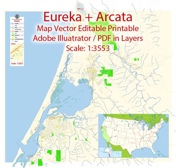
Arcata and Eureka are two cities located in Humboldt County, California, United States. They are situated along the northern California coast and are known for their natural beauty and proximity to the Pacific Ocean. Here’s some information about their water resources and bridges:
Water Resources:
- Mad River: The Mad River is a significant water resource in the area. It flows through both Arcata and Eureka and is known for its scenic beauty. The river is used for recreational activities like kayaking, fishing, and swimming.
- Humboldt Bay: Humboldt Bay is a large, natural bay located near Eureka. It plays a vital role in the region’s water resources and provides access to the Pacific Ocean. It is used for commercial shipping, recreation, and is an important estuarine habitat for various wildlife.
- Eel River: While not directly in Arcata or Eureka, the Eel River is a major river in Humboldt County that provides additional water resources to the region. It is known for its diverse ecosystem and is an important source of water for various uses.
- Drinking Water: Both Arcata and Eureka have water treatment facilities that provide clean drinking water to their residents. The Arcata Community Services District and the City of Eureka’s Water Department are responsible for managing water resources and distribution in their respective areas.
Bridges:
- Samoa Bridge: The Samoa Bridge connects Eureka to the Samoa Peninsula, which is located on Humboldt Bay. This bridge is a crucial transportation link in the area, allowing access to the peninsula, which is home to industries and communities.
- Mad River Bridge: The Mad River Bridge is part of U.S. Route 101 and carries traffic over the Mad River as it flows into the Pacific Ocean. This bridge is important for travelers heading north or south along the coastal highway.
- G Street Overpass: In Eureka, the G Street Overpass is an elevated road that provides a connection over the rail lines near the waterfront, ensuring smooth traffic flow in the city.
- Other Bridges: There are numerous smaller bridges in both Arcata and Eureka, spanning various creeks and waterways, facilitating local transportation.
The water resources and bridges in the Arcata-Eureka region are essential for the local economy, transportation, and the overall quality of life for residents and visitors. These natural and man-made features contribute to the charm and functionality of the area.


 Author: Kirill Shrayber, Ph.D. FRGS