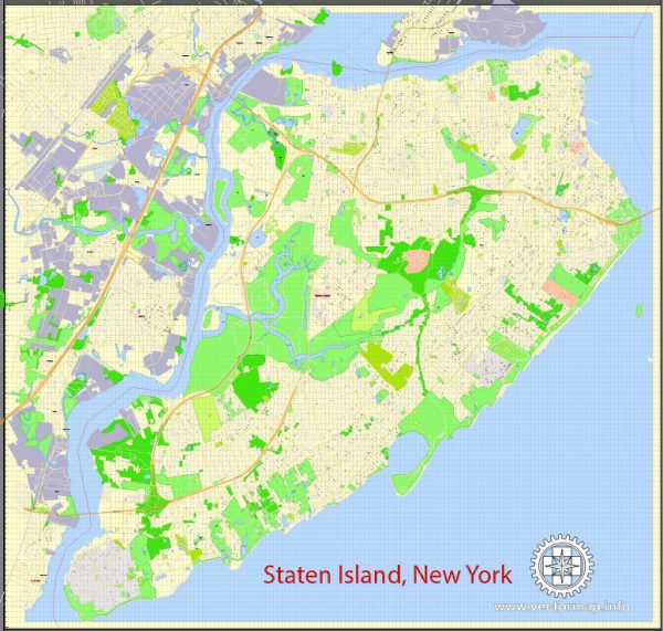
Staten Island is one of the five boroughs of New York City, and while it may not be as famous as Manhattan, it still has some notable streets and areas. Here are a few of the most well-known streets and areas in Staten Island:
- Hylan Boulevard: Hylan Boulevard is one of the major thoroughfares on Staten Island. It runs from the Verrazano-Narrows Bridge in the north to Tottenville in the south. It’s known for its many shops, restaurants, and businesses.
- Victory Boulevard: Victory Boulevard is another important road on Staten Island. It stretches from the Staten Island Ferry terminal in St. George to Travis in the west. It’s home to a variety of shops and services and is a key route for commuters.
- Bay Street: Bay Street is a prominent street along the eastern shore of Staten Island. It offers views of the Upper New York Bay and the Manhattan skyline. St. George, located at the northern end of Bay Street, is home to the Staten Island Ferry Terminal and the Staten Island Yankees’ baseball stadium.
- Richmond Avenue: Richmond Avenue is a major north-south thoroughfare that runs through the center of Staten Island. It features a mix of residential areas, shopping centers, and restaurants.
- Forest Avenue: Forest Avenue is a popular shopping district in the neighborhoods of West Brighton and Mariners Harbor. It has a variety of stores, eateries, and cultural attractions.
- Arthur Kill Road: Arthur Kill Road is another significant street on Staten Island that runs from Tottenville in the south to Rossville in the north. It is home to a variety of businesses and communities.
- Huguenot Avenue: Huguenot Avenue is a well-known road in the southern part of Staten Island, running through areas like Huguenot, Annadale, and Prince’s Bay.
- Clove Road: Clove Road is located on the western side of Staten Island and provides access to neighborhoods like Sunnyside and West Brighton. It’s known for its tree-lined streets and historic sites.
These streets are some of the most famous and frequently traveled routes on Staten Island. Each of them offers a unique character and access to various attractions and amenities throughout the borough.


 Author: Kirill Shrayber, Ph.D. FRGS