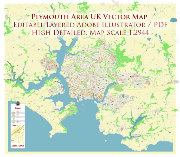
Plymouth is a city located on the south coast of England in the United Kingdom. It is part of the ceremonial county of Devon and is situated in the southwestern region of the country. Here’s a geographical description of Plymouth:
- Coastal Location: Plymouth is a coastal city, overlooking the English Channel to the south. It has a natural harbor known as Plymouth Sound, which has played a significant role in the city’s history as a naval base.
- Latitude and Longitude: The city is approximately located at 50.3755° N latitude and 4.1427° W longitude.
- Topography: The terrain in and around Plymouth is characterized by a mixture of rolling hills and valleys, which extend to the coastline. Dartmoor National Park is not far from Plymouth, and it offers rugged moorland and tors that are popular for hiking and outdoor activities.
- Rivers: The city is situated near the mouths of the River Plym and the River Tamar, both of which flow into Plymouth Sound. These rivers contribute to the estuarine environment of the area.
- Climate: Plymouth experiences a maritime climate with mild temperatures and relatively high levels of precipitation throughout the year. Winters are typically mild, and summers are relatively cool compared to more inland areas of the UK.
- Beaches: The coastline around Plymouth features numerous beaches, including popular ones like Plymouth Hoe and Whitsand Bay. These beaches are popular for swimming, sunbathing, and various water sports.
- Landmarks: Plymouth is known for landmarks such as the Royal Citadel, Smeaton’s Tower lighthouse, and the Royal William Yard. The city’s waterfront area, with its promenade and views of Plymouth Sound, is also a significant feature.
- Islands: The city is surrounded by various small islands, including Drake’s Island and the Mew Stone, which are located in Plymouth Sound and have historical significance.
- Naval Heritage: Plymouth has a rich maritime history, and it is closely associated with the Royal Navy. The Devonport Dockyard is one of the largest naval dockyards in Europe and has played a crucial role in the city’s development.
- Transportation: Plymouth is well-connected to the rest of the UK through road and rail links, and it has a ferry terminal with connections to France and Spain. The city also has an airport, Plymouth City Airport, with domestic and international flights.
Plymouth’s geographical location, with its coastal beauty and historical significance, makes it an attractive destination for both residents and tourists.


 Author: Kirill Shrayber, Ph.D. FRGS