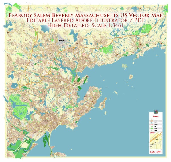
The cities of Peabody, Salem, and Beverly are located on the North Shore of Massachusetts in the United States, and each of them offers its own unique blend of natural beauty and outdoor recreational opportunities. Here’s a brief description of the nature and natural attractions you can find in these areas:
- Peabody, Massachusetts:
- Brooksby Farm: This historic farm in Peabody offers not only fresh produce but also a picturesque landscape with rolling hills, orchards, and walking trails.
- Crystal Lake: Located in Peabody’s southern end, Crystal Lake is a popular spot for fishing, kayaking, and picnicking. The surrounding park provides a serene setting for outdoor activities.
- Salem, Massachusetts:
- Salem Willows Park: This coastal park in Salem features beautiful views of the Atlantic Ocean and Salem Harbor. It’s a great place for a leisurely walk along the shore or a picnic by the sea.
- Salem Woods: This forested area in Salem offers numerous trails for hiking and birdwatching. It’s a peaceful escape from the city’s bustle and a great place to explore nature.
- Beverly, Massachusetts:
- Lynch Park: Beverly’s Lynch Park is known for its stunning rose gardens and the Beverly Shell, which hosts outdoor concerts in the summer. The park also offers waterfront views and a beach for relaxation.
- Dane Street Beach: This small, sandy beach in Beverly is a lovely place to take in the ocean air and enjoy a day by the water.
The North Shore region as a whole is characterized by its proximity to the ocean, which means you can enjoy picturesque coastal scenery, beachcombing, and water-based activities such as swimming and boating. Additionally, the area features a mix of wooded areas, parks, and nature reserves, making it suitable for those who love outdoor adventures, hiking, and nature exploration.
The natural beauty of these cities is further enhanced by the New England seasons, with colorful foliage in the fall and the refreshing ocean breeze in the summer, making it a desirable destination for nature enthusiasts.


 Author: Kirill Shrayber, Ph.D. FRGS