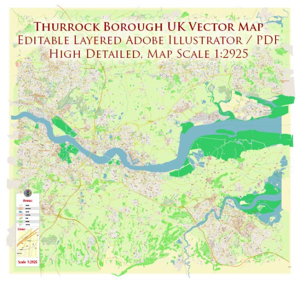
City Plan Map Thurrock Borough UK

Map — Map Thurrock Borough UK

An accurate map of Map Thurrock Borough UK that keeps hierarchy under control when scaling from A3 to A0. Typography spacing is tuned for quick reading on posters, brochures and reports. The file accepts custom grids, legends and callouts without redrawing base content. District and neighborhood labels are arranged to avoid collisions around dense cores. Waterfronts and parks receive extra separation for better contrast on light palettes. Coordinates and scales are prepared for sheet production and consistent exports.

Saves prepress time by reducing manual fixes and keeping the visual system consistent. Works well as an underlay for wayfinding, transport schemes and editorial layouts. The map integrates neatly with common DTP and GIS workflows. Editors can brand the palette and icons, then export sharp results for both print and web. Export presets help maintain crisp strokes on both coated and uncoated paper.

Thurrock is a unitary authority and borough in Essex, England. It encompasses several towns and communities, each with its own principal streets and roadways. Here are some of the key streets and areas within Thurrock:

  1. Grays:
    • Orsett Road
    • High Street
    • London Road
    • Derby Road
    • Bridge Road
  2. Tilbury:
    • Civic Square
    • Dock Road
    • Calcutta Road
    • Civic Square
  3. Stanford-le-Hope:
    • High Street
    • Corringham Road
    • London Road
  4. Corringham:
    • St. John’s Way
    • Southend Road
    • Springhouse Road
  5. Purfleet:
    • Arterial Road
    • London Road
    • Centurion Way
  6. South Ockendon:
    • Daiglen Drive
    • Derwent Parade
    • North Road
    • South Road
  7. Chafford Hundred:
    • Drake Road
    • Burghley Lane
    • Devonshire Road
  8. Aveley:
    • High Street
    • Purfleet Road
    • The Parade

Please note that this list is not exhaustive, and Thurrock has many more streets and roads in its various towns and neighborhoods. If you’re looking for a specific street or need more information, it’s a good idea to consult a local map or navigation app for up-to-date information.

Author: Kirill Shrayber, Ph.D.

I have been working with vector cartography for over 25 years, including GPS, GIS, Adobe Illustrator and other professional cartographic software.
Linkedin: https://www.linkedin.com/in/kirill-shrayber-0b839325/
Twitter: https://twitter.com/vectormapper

Are we missing some maps? Let us know!!!
What map do you need?

    We will upload it within the next 24 hours and notify you by Email.

    Menu