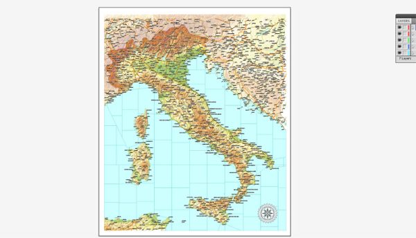
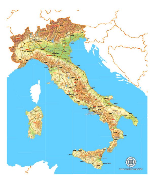
Italy’s geology is both diverse and complex due to its position at the boundary of several tectonic plates. The country is primarily located on the Eurasian Plate, but it also encompasses significant portions of the African Plate and the Adriatic Plate. This tectonic complexity has given rise to various geological features and hazards, making Italy a fascinating region for geologists.
Here’s a general description of Italy’s geology:
- Mountain Ranges: Italy is well-known for its mountain ranges, which result from the collision of the African Plate and the Eurasian Plate. The most famous of these ranges is the Alps in the north, which extend into Italy and include the Dolomites. In the south, you have the Apennines, a long chain of mountains that runs the length of the Italian Peninsula.
- Volcanoes: Italy is home to several active volcanoes due to its location along the boundary of the African Plate and the Eurasian Plate. Mount Vesuvius, near Naples, and Mount Etna in Sicily are among the most famous. These volcanoes have been active for centuries and pose a risk to the surrounding population.
- Tectonic Faults: Italy has several active tectonic faults, including the famous San Andreas Fault, which runs through the Apennines and is responsible for frequent earthquakes in the region. The interaction of these faults is a significant geological concern.
- Karst Landscapes: In parts of Italy, particularly in the region of Apulia (Puglia) and along the Adriatic coast, there are karst landscapes. These areas feature limestone formations, caves, sinkholes, and underground rivers, which are the result of chemical and physical weathering of limestone rock.
- Coastlines and Islands: Italy has a diverse coastline, with cliffs, sandy beaches, and rugged terrain. The geology of the coastline varies from region to region. Additionally, Italy boasts numerous islands, such as Sicily and Sardinia, each with its geological characteristics.
- Mineral Resources: Italy has been historically known for its rich mineral deposits. These include marble in Carrara, volcanic rocks in the Vesuvius region, and various other resources like limestone, gypsum, and more.
- Sedimentary Basins: Some areas in Italy, such as the Po Valley in the north, are sedimentary basins that have filled with alluvial deposits, making them fertile areas for agriculture.
- Geological Hazards: Given the geological complexity of Italy, it’s susceptible to natural hazards like earthquakes, volcanic eruptions, landslides, and flooding. These hazards have had significant historical and cultural impacts on the country.
In summary, Italy’s geology is a reflection of its complex tectonic setting, resulting in a diverse range of geological features, from mountains and volcanoes to coastal landscapes and sedimentary basins. The geological hazards in Italy, particularly earthquakes and volcanic eruptions, are of ongoing concern and have shaped the country’s history and culture.


 Author: Kirill Shrayber, Ph.D.