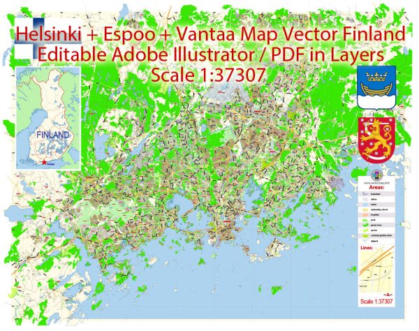
Helsinki, Espoo, and Vantaa are all part of the Greater Helsinki metropolitan area in Finland. The region has a well-developed and efficient public transportation system that makes it easy for residents and visitors to get around. Here are some key components of the transport system in these cities:
- Helsinki Region Transport (HSL): HSL is the regional authority responsible for public transportation in the Helsinki metropolitan area. It coordinates buses, trams, the metro, commuter trains, and ferry services. HSL’s website and mobile app provide information on routes, schedules, and ticket options.
- Trams: Helsinki has an extensive tram network, which is a popular mode of transport within the city. Espoo and Vantaa are also connected to Helsinki’s tram system.
- Metro: The Helsinki Metro connects several parts of the city and extends into Espoo. It’s a fast and efficient way to travel between different areas.
- Buses: Buses are a common mode of transport in the region. They serve both urban and suburban areas and are integrated with other transportation options. Express buses provide quick connections to outlying areas.
- Commuter Trains: Helsinki’s commuter train network extends into Espoo and Vantaa, making it easy for people to commute to and from work or school.
- Ferries: Due to the presence of the Gulf of Finland, there are regular ferry services connecting various islands and parts of the cities, providing an interesting mode of transport.
- Bicycle Infrastructure: The cities have invested in bicycle lanes and bike-sharing programs, making cycling a popular and eco-friendly way to get around.
- Walking: Many parts of the cities are pedestrian-friendly, with well-maintained sidewalks and pedestrian zones. Walking is a common way to explore the urban areas.
- Transportation Cards: HSL offers various transportation cards, such as travel cards and season tickets, which provide convenience and cost savings for regular users of public transport.
- Helsinki-Vantaa Airport: Helsinki’s international airport, located in Vantaa, is the main gateway for travelers to and from the region. It’s well-connected to the city center by commuter trains and buses.
- Planned Expansions: The Helsinki metropolitan area is continually working on expanding and improving its public transportation system, with new metro lines and extensions planned for the future.
Travelers and residents can access up-to-date information on schedules, routes, and ticket prices through HSL’s official website, mobile apps, and customer service centers. The public transportation system in the Helsinki metropolitan area is known for its reliability and convenience, making it a great way to explore the region.


 Author: Kirill Shrayber, Ph.D. FRGS