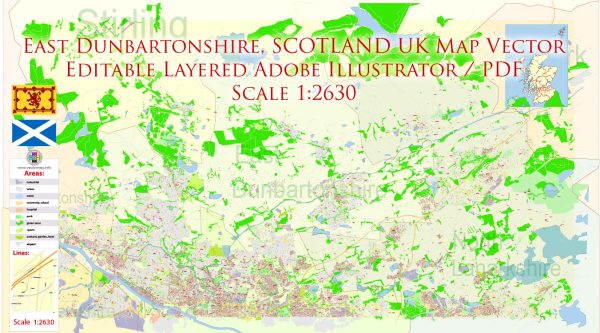
East Dunbartonshire is a council area located in the west-central region of Scotland, United Kingdom. It encompasses a diverse range of geological features and landscapes. The geology of East Dunbartonshire includes elements from several geological periods, which have shaped the area’s topography and landforms. Here is a general description of the geology of East Dunbartonshire:
- Carboniferous Rocks: The predominant geological formation in East Dunbartonshire is the Carboniferous rocks, which are associated with the Carboniferous period, approximately 359 to 299 million years ago. These rocks consist of sandstone, shale, limestone, and coal measures. The rocks are primarily from the lower and middle Carboniferous periods and were deposited in a shallow tropical sea.
- Drumchapel and Campsie Faults: The area is dissected by geological fault lines, including the Drumchapel Fault and Campsie Fault. These faults are significant in shaping the landscape and can be seen in the topography of the region.
- Glacial Deposits: During the Pleistocene epoch (Ice Age), the area was covered by glaciers, which deposited various glacial materials. These deposits include till, boulder clay, and glacial erratics. These materials contribute to the landscape and the composition of soils in the region.
- River Valleys: East Dunbartonshire is crossed by several rivers, including the River Kelvin and the Allander Water. These rivers have carved out valleys in the Carboniferous rocks, creating a variety of landscapes, including wooded valleys and riverbanks.
- Hills and Uplands: The northern part of East Dunbartonshire is part of the Campsie Fells, which are a range of hills and uplands formed from volcanic rocks. The Campsie Fells offer opportunities for hiking and outdoor activities and are distinct from the lower-lying Carboniferous rocks found in the southern part of the region.
- Quarrying and Mining: In the past, there were quarries and mines in the area that exploited resources like sandstone and coal. These activities have left their mark on the landscape and contributed to the local economy.
- Natural Environment: The geology of East Dunbartonshire has played a crucial role in shaping the natural environment, including the types of vegetation and wildlife that can be found in the region.
East Dunbartonshire’s geology has influenced its cultural and economic history, as well as its natural beauty. It is a region with a rich geological heritage and diverse landscapes that offer a range of opportunities for outdoor activities and exploration.


 Author: Kirill Shrayber, Ph.D. FRGS