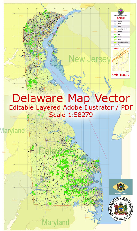
Delaware is a small state located on the east coast of the United States. Its geology is primarily characterized by its low-lying coastal plains, with a few distinct geological features and formations. Here is a brief description of the geology of Delaware:
- Coastal Plain: The majority of Delaware’s land area is part of the Atlantic Coastal Plain, a relatively flat and low-lying region that extends from New Jersey to Florida. This coastal plain was formed by the deposition of sediments over millions of years, resulting in a landscape dominated by sand, clay, silt, and gravel.
- Sedimentary Rocks: Delaware’s geology is predominantly composed of sedimentary rocks, including layers of sand, clay, and gravel. These rocks were deposited over time as sea levels rose and fell, creating the flat landscape seen in the state today.
- Delaware River Basin: The northern part of Delaware is influenced by the Delaware River Basin, which includes the Christina River and Brandywine Creek. These waterways have shaped the local geology through erosion and sediment deposition.
- Chesapeake and Delaware Canal: This artificial waterway, which connects the Delaware River and Chesapeake Bay, has had a significant impact on the state’s geology. It was constructed in the 19th century and involved extensive excavation and dredging to create the canal, altering the local landscape.
- Coastal Features: Delaware has a relatively short coastline along the Atlantic Ocean, which features sandy beaches and barrier islands. The shifting sands and dunes along the coast are constantly shaped by ocean currents and storms.
- Fossils: Delaware’s geology contains fossil deposits from the Cretaceous period, which can be found in some parts of the state. Fossils of ancient marine life, such as mollusks and other creatures, can be uncovered in certain areas.
- Wetlands and Marshes: The state is also home to extensive wetlands and marshes, particularly in its coastal regions. These areas play a crucial role in the state’s ecology and are shaped by the interaction of land and water.
- Groundwater: Delaware’s geology plays a vital role in the state’s groundwater resources. The coastal plain contains aquifers that supply drinking water to many of the state’s residents.
- Karst Features: In some parts of northern Delaware, there are karst features, including sinkholes and limestone formations. These areas are relatively small but offer unique geological characteristics.
- Tectonic Activity: Delaware is not situated near tectonic plate boundaries, so it experiences minimal seismic activity and does not have significant mountain ranges or volcanoes.
Overall, Delaware’s geology is relatively uneventful compared to some other U.S. states, but it is essential in shaping the state’s landscapes, natural resources, and environmental characteristics. The coastal plain and its associated features have a profound influence on the state’s culture, economy, and environment.


 Author: Kirill Shrayber, Ph.D. FRGS