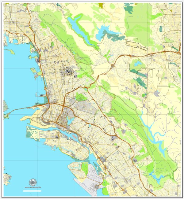
The Alameda-Oakland-Berkeley area in California, USA, is part of the San Francisco Bay Area and has a well-developed transportation system that includes various options for getting around. Here’s an overview of the transportation options in this region:
- BART (Bay Area Rapid Transit): BART is a regional rapid transit system that connects Oakland, Berkeley, and Alameda to other parts of the San Francisco Bay Area. BART trains run frequently, making it a popular choice for commuters. There are BART stations in downtown Oakland, Berkeley, and in some parts of Alameda.
- AC Transit: AC Transit is the public bus system serving Alameda and Contra Costa Counties. It provides bus services within and between cities, including Oakland, Berkeley, and Alameda. AC Transit offers an extensive network of bus routes in the area.
- Ferries: Alameda and Oakland have ferry services that connect to San Francisco. The Alameda/Oakland Ferry Terminal is a convenient option for those looking to travel across the San Francisco Bay.
- Amtrak: Amtrak provides train services connecting the Bay Area with other parts of California and the United States. The Amtrak station in Oakland, known as the Oakland Jack London Square station, is a major transportation hub.
- Freeways and Roads: The area is well-connected by an extensive network of freeways and roads. Interstate 80, Interstate 580, and Interstate 880 are some of the major highways that pass through or near these cities.
- Bicycling: The Alameda-Oakland-Berkeley area is bike-friendly with numerous bike lanes and bike-sharing programs. Many residents use bicycles as a means of transportation, and there are efforts to improve bike infrastructure.
- Walking: The downtown areas of Oakland, Berkeley, and Alameda are pedestrian-friendly, with various amenities and shops within walking distance.
- Ridesharing and Taxis: Ridesharing services like Uber and Lyft are widely available in the region, making it easy to get around via private rides. Traditional taxi services are also available.
- Oakland International Airport: Oakland International Airport is the nearest airport to the Alameda-Oakland-Berkeley area. It provides domestic and international flights and serves as a convenient transportation option for air travelers.
- Carpooling: The Bay Area has carpool lanes on many major highways, and carpooling is encouraged as a means of reducing traffic congestion and promoting sustainability.
These transportation options make it relatively easy to travel within and between Alameda, Oakland, and Berkeley, as well as to other parts of the San Francisco Bay Area and beyond. The availability of public transit, road infrastructure, and alternative transportation options makes it possible for residents and visitors to navigate the region efficiently.


 Author: Kirill Shrayber, Ph.D. FRGS