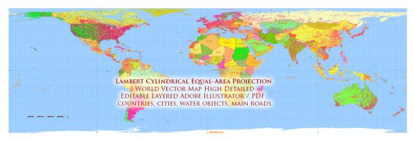
The Lambert cylindrical equal-area projection, also known as the Lambert projection, is a type of map projection that was developed by the Swiss mathematician and physicist Johann Heinrich Lambert in the 18th century. Lambert introduced this projection in his 1772 publication, “Mémoire sur la projection des cartes géographiques,” which was published posthumously.
The Lambert projection is classified as an equal-area projection, meaning that it preserves the relative sizes of areas on the Earth’s surface. This makes it particularly useful for thematic mapping and cartography when accurate representation of areas is essential. The projection is cylindrical, with the standard parallel being a straight line, and meridians and parallels are straight lines perpendicular to each other, making it straightforward to use.
The Lambert projection has been adapted and modified in various ways to suit different needs. One of the most well-known adaptations is the Lambert Conformal Conic projection, which is often used for mapping regions that span a relatively large range of latitudes, such as North America. The Lambert Azimuthal Equal-Area projection is another variant that is often employed for global maps, as it minimizes distortion at a single point on the map.
Overall, the Lambert projection and its derivatives have been significant tools in the field of cartography and mapmaking, offering a balance between preserving area accuracy and maintaining relative shapes, which is crucial for various mapping applications.


 Author: Kirill Shrayber, Ph.D. FRGS