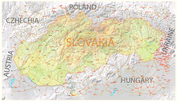
Slovakia is a landlocked country located in Central Europe. Here are some key facts about Slovakia:
- Capital: The capital of Slovakia is Bratislava.
- Location: Slovakia is bordered by Poland to the north, Ukraine to the east, Hungary to the south, Austria to the west, and the Czech Republic to the northwest.
- Population: As of my last knowledge update in September 2021, Slovakia had a population of approximately 5.5 million people.
- Language: The official language of Slovakia is Slovak.
- Government: Slovakia is a parliamentary republic with a multi-party system. It has a President as the head of state and a Prime Minister as the head of government.
- Currency: The currency used in Slovakia is the Euro (EUR), as Slovakia adopted the Euro in 2009.
- Geography: The country is characterized by a diverse landscape, including mountains (the Carpathian Mountains are present in the north), forests, plains, and rivers.
- Economy: Slovakia has a developed and export-oriented economy, with a focus on automotive and manufacturing industries. It is part of the European Union and the Eurozone.
- History: Slovakia was formerly part of Czechoslovakia until the peaceful dissolution of the country in 1993. Since then, it has been an independent nation.
- Tourism: Slovakia has a rich cultural heritage and natural beauty. It’s known for its historical towns, castles, national parks, and outdoor recreational activities. The High Tatras in the north are a popular destination for hiking and winter sports.


 Author: Kirill Shrayber, Ph.D. FRGS