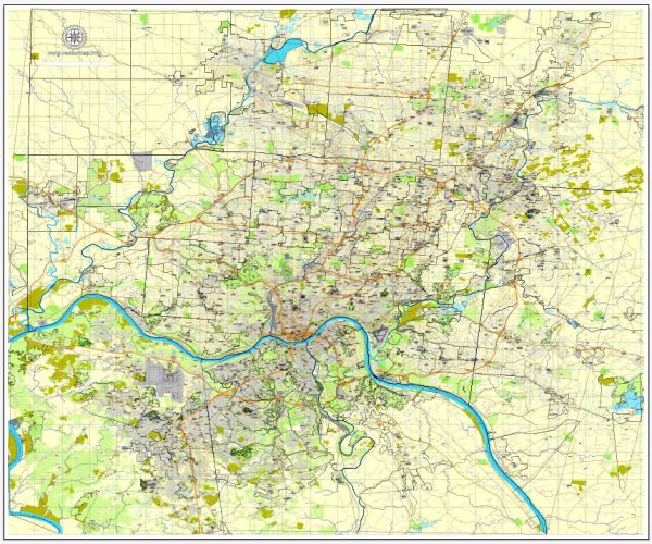
Cincinnati Ohio US Map

Map — Cincinnati Ohio US Map

A clean map of Cincinnati Ohio US Map with named layers and consistent geometry for fast cartographic work. Crisp vectors preserve edges at high DPI and export compactly for web delivery. Coordinates and scales are prepared for sheet production and consistent exports. Named layers let you restyle colors, line weights and label classes without cleanup passes. Typography spacing is tuned for quick reading on posters, brochures and reports. The file accepts custom grids, legends and callouts without redrawing base content.

Works well as an underlay for wayfinding, transport schemes and editorial layouts. Use it for visitor guides, city infographics, investment decks and municipal communications. Color systems can be swapped quickly to match seasonal or brand variants. Keeps labels readable while allowing deep customization of routes and highlights. Legibility holds up on handheld leaflets and large lobby posters alike.

Vector Maps of the Cincinnati Ohio US for design and printing, royalty free
Instant download archives: royalty free, editable vector maps of Cincinnati Ohio US in high resolution
digital PDF and Adobe Illustrator format.

All of these editable Cincinnati Ohio US vector maps are digital files,
which can be instantly downloaded in editable PDF or Adobe Illustrator format.
Objects on maps are usually divided into layers according to their types – lines, polygons,
street names, object names (see map description!!!!)
Each of these Cincinnati Ohio US digital maps is available in Adobe Illustrator or editable PDF format,
(or on request in any other known format for the same price)
which use a vector approach to display images,
you can easily enlarge any part of these maps without compromising text, line or graphic quality,
with any increase or decrease ratio.
Using a vector graphics editor such as Adobe Illustrator, CorelDraw, Inkscape, or Freehand
you can easily crop parts of the map, add custom characters, and change colors and font attributes as needed.
We have a variety of Cincinnati Ohio US vector maps with different levels of detail,
from simple empty paths to highly detailed maps with roads and terrain layers.

Author: Kirill Shrayber, Ph.D.

I have been working with vector cartography for over 25 years, including GPS, GIS, Adobe Illustrator and other professional cartographic software.
Linkedin: https://www.linkedin.com/in/kirill-shrayber-0b839325/
Twitter: https://twitter.com/vectormapper

Are we missing some maps? Let us know!!!
What map do you need?

    We will upload it within the next 24 hours and notify you by Email.

    Menu