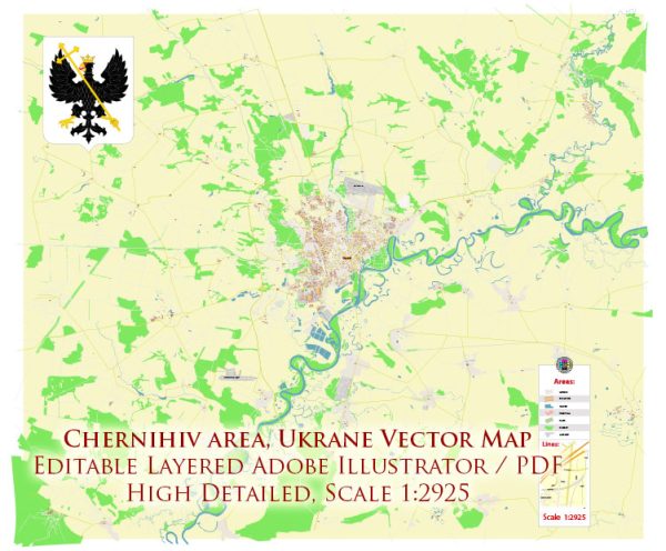
Geographic Description of Chernihiv, Ukraine
Chernihiv (Ukrainian: Чернігів) is a historic city in northern Ukraine, serving as the administrative center of Chernihiv Oblast. The city lies along the banks of the Desna River, a significant tributary of the Dnieper River, and is approximately 140 kilometers (87 miles) northeast of Kyiv, Ukraine’s capital.
Topography and Location
- Coordinates: Approximately 51°30′N, 31°18′E.
- Elevation: Chernihiv is situated at an elevation of 120–150 meters (394–492 feet) above sea level.
- Landscape: The area features rolling plains and fertile soils, characteristic of the northern Ukrainian Polissya region. This region is known for its mixed forests, wetlands, and flat river valleys.
- Rivers: The Desna River is the most prominent natural feature, providing a natural corridor for trade and settlement since ancient times. Smaller rivers such as the Strizhen also flow through the city.
Climate
- Chernihiv experiences a humid continental climate (Dfb), with:
- Cold winters: Average temperatures in January are around -6°C (21°F).
- Warm summers: July temperatures average 19–21°C (66–70°F).
- Moderate precipitation year-round, with a peak during late spring and summer.
Natural Features
- Forests: The outskirts of Chernihiv are dotted with deciduous forests and some pine stands, remnants of the vast woodlands that historically covered the region.
- Parks and Green Spaces: Chernihiv is known for its picturesque parks, including Boldyna Hora and other landscaped gardens.
Urban Layout
- The city has a blend of historical and modern neighborhoods:
- The historic core includes medieval churches and ancient fortifications.
- Modern expansions stretch outward, incorporating Soviet-era and contemporary residential and industrial zones.
- Major roads connect Chernihiv to Kyiv, Gomel (Belarus), and other regional centers.
Historical Overview of Chernihiv
Early History
- Origins: Archaeological evidence suggests that Chernihiv has been inhabited since at least the 7th century. By the 10th century, it was a major settlement of the East Slavs.
- Kyivan Rus’: In the 10th and 11th centuries, Chernihiv became one of the most important cities of the Kyivan Rus’. It served as the capital of the Principality of Chernihiv, second only to Kyiv in prominence.
- Cultural Flourishing: The city’s golden age was marked by the construction of iconic churches, such as the Cathedral of the Transfiguration of the Savior (built in 1036) and St. Elijah’s Church.
Medieval and Early Modern Periods
- Mongol Invasion (1239): Chernihiv suffered significant destruction during the Mongol invasion of the Kyivan Rus’.
- Lithuanian and Polish Rule: From the 14th century, the city came under the rule of the Grand Duchy of Lithuania, followed by the Polish-Lithuanian Commonwealth.
- Cossack Hetmanate: In the 17th century, Chernihiv became a part of the Cossack Hetmanate under the suzerainty of the Russian Tsardom. It gained significance as a regional religious and cultural center.
19th and Early 20th Centuries
- Russian Empire: Chernihiv became a provincial center within the Russian Empire, witnessing industrial development and the construction of infrastructure, including railways.
- Ukrainian National Awakening: The city played a role in the late 19th and early 20th-century movements for Ukrainian cultural and political autonomy.
Soviet Era
- Industrialization: During Soviet times, Chernihiv was developed as an industrial hub, producing machinery, textiles, and food products.
- World War II: Chernihiv endured heavy destruction during the Nazi occupation from 1941 to 1943. Post-war reconstruction restored much of the city.
Post-Independence Era
- 1991 Onward: Since Ukraine’s independence in 1991, Chernihiv has focused on preserving its historical and cultural heritage while modernizing its economy.
- Recent Conflict: In 2022, during the Russian invasion of Ukraine, Chernihiv was heavily bombarded, resulting in significant damage to infrastructure and cultural landmarks.
Cultural and Historical Significance
Chernihiv is renowned for its medieval architecture, including:
- Ancient churches: The Transfiguration Cathedral, Boris and Gleb Cathedral, and Yeletsky Monastery.
- Boldyna Hora: A historic burial mound area with stunning views and deep cultural roots.
The city’s long history as a political, economic, and cultural center has made it a symbol of Ukrainian resilience and heritage.
Mapas vectoriales de los Chernihiv Ukraine para diseño e impresión, libre de regalías
Archivos de descarga instantánea: mapas vectoriales editables libres de regalías de Chernihiv Ukraine en alta resolución
PDF digital y formato Adobe Illustrator.
Todos estos mapas vectoriales editables Chernihiv Ukraine son archivos digitales,
que se puede descargar instantáneamente en formato PDF editable o Adobe Illustrator.
Los objetos en los mapas generalmente se dividen en capas según sus tipos: líneas, polígonos,
nombres de calles, nombres de objetos (ver descripción del mapa!!!!)
Cada uno de estos mapas digitales Chernihiv Ukraine está disponible en Adobe Illustrator o en formato PDF editable,
(o bajo pedido en cualquier otro formato conocido por el mismo precio)
que utilizan un enfoque vectorial para mostrar imágenes,
puede ampliar fácilmente cualquier parte de estos mapas sin comprometer la calidad del texto, las líneas o los gráficos,
con cualquier proporción de aumento o disminución.
Usar un editor de gráficos vectoriales como Adobe Illustrator, CorelDraw, Inkscape o Freehand
puede recortar fácilmente partes del mapa, agregar caracteres personalizados y cambiar colores y atributos de fuente según sea necesario.
Tenemos una variedad de mapas vectoriales Chernihiv Ukraine con diferentes niveles de detalle,
desde simples caminos vacíos hasta mapas muy detallados con carreteras y capas de terreno.


 Author: Kirill Shrayber, Ph.D. FRGS