AutoCAD Map Medford Oregon US

AutoCAD Map — Medford Oregon US

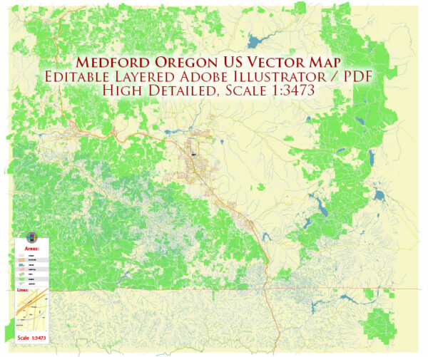
A production‑ready AutoCAD map of Medford Oregon US built for clear labeling and predictable output across sizes. Waterfronts and parks receive extra separation for better contrast on light palettes. District and neighborhood labels are arranged to avoid collisions around dense cores. Layer structure separates arterials and locals, districts, hydrography, parks and landmarks. Named layers let you restyle colors, line weights and label classes without cleanup passes. Contours and landuse layers can be toggled to match tourism or planning use cases.

Use it for visitor guides, city infographics, investment decks and municipal communications. Saves prepress time by reducing manual fixes and keeping the visual system consistent. Legibility holds up on handheld leaflets and large lobby posters alike. Reliable as a base layer; easy to adapt when projects or sponsors change.

Medford is a city located in southern Oregon, United States. It is the county seat of Jackson County and is situated in the Rogue Valley. As of my last knowledge update in September 2021, Medford is known for its beautiful natural surroundings, including the nearby Rogue River, the Cascade Range to the east, and the Siskiyou Mountains to the west.

Medford is the largest city in the region and serves as a hub for commerce, healthcare, education, and transportation. It is known for its vibrant agricultural and wine industries, and the city is also home to Rogue Valley International-Medford Airport, making it a convenient gateway to the surrounding area.

The city offers a range of recreational opportunities, including hiking, fishing, and boating in the nearby wilderness areas and parks. Medford is also known for its wineries and vineyards, contributing to the region’s growing reputation as a wine destination. Additionally, the city hosts cultural events and festivals, making it a lively place to visit and live.

Author: Kirill Shrayber, Ph.D.

I have been working with vector cartography for over 25 years, including GPS, GIS, Adobe Illustrator and other professional cartographic software.
Linkedin: https://www.linkedin.com/in/kirill-shrayber-0b839325/
Twitter: https://twitter.com/vectormapper

Are we missing some maps? Let us know!!!
What map do you need?

    We will upload it within the next 24 hours and notify you by Email.

    Menu